October 2022 Weather Outlook (and more)
What is a typical October like according to climate statistics?
|
Mean Maximum Temperature |
Mean Minimum Temperature | Mean Temperature | Total Rainfall |
| 24.8°C | 17.9°C | 21.4°C |
83.3 mm |
What do long-term weather maps indicate for October 2022?
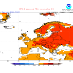
Long-term maps are providing an interesting outlook for October 2022. Overall, it is likely to be around average or slightly warmer than average. The warm sea will continue exerting its influence on minimum temperatures, meaning that nights will likely continue to be noticeably warmer than normal. Some maps suggest the possibility of a cooler spell around the third week of the month. This can only be confirmed at a later date. The consensus among long-term maps is stronger where precipitation is concerned. It could be a drier than average month overall. The first half of the month is likely to be very dry, with only the odd isolated shower on one or two days. In similar fashion to September, the situation may change somewhat as enter the second half of October. It’s still too early to pinpoint an exact date, but maps are pointing towards the possibility of two separate episodes of instability: a period of isolated showers around mid-month and potentially widespread rainfall towards the end of the month. Although maps are almost certain of instability around the central Mediterranean at that time, only time will tell whether or not that will affect the Maltese Islands directly or not.
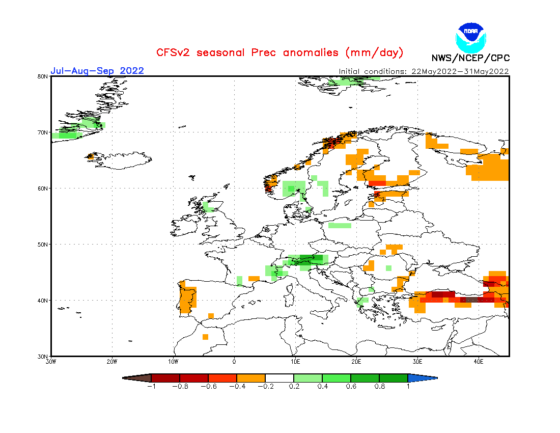
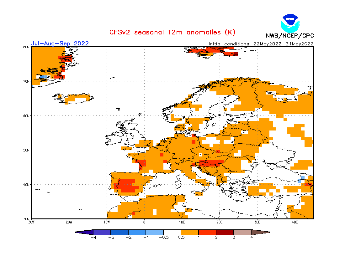
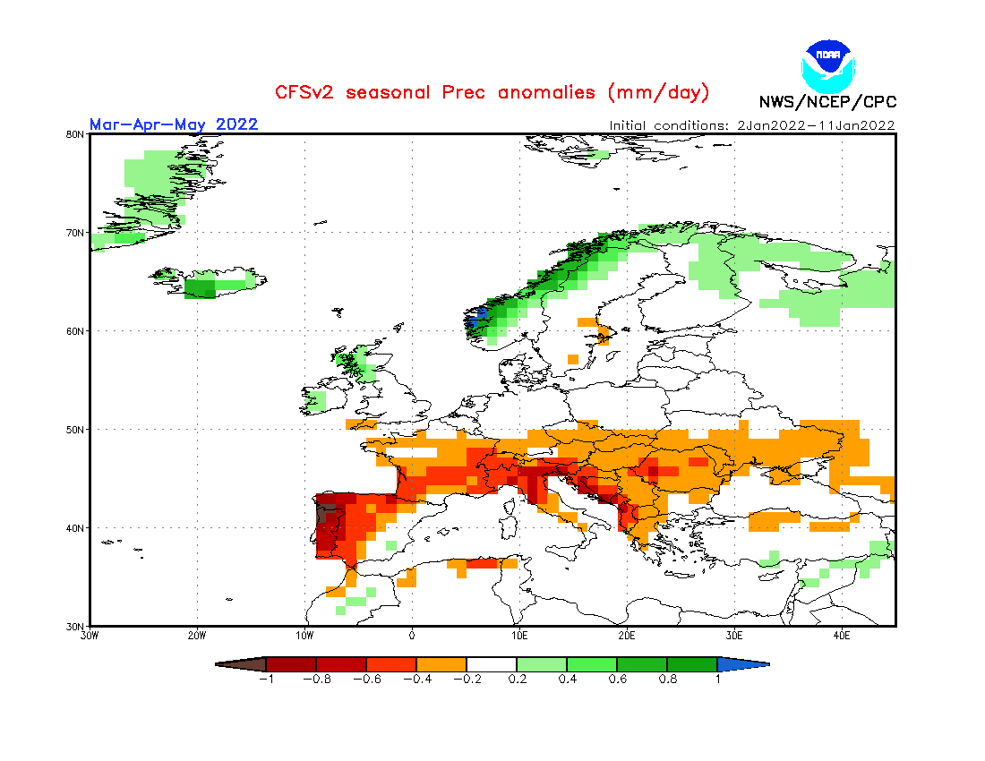
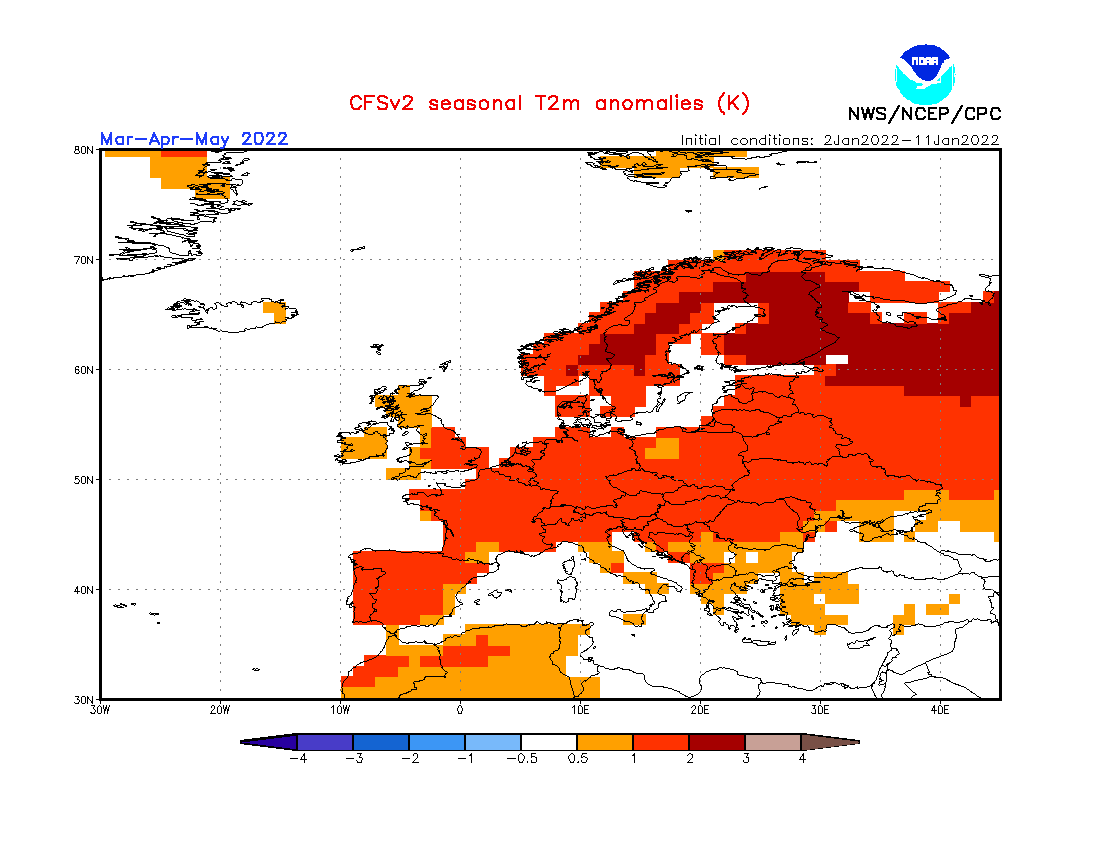
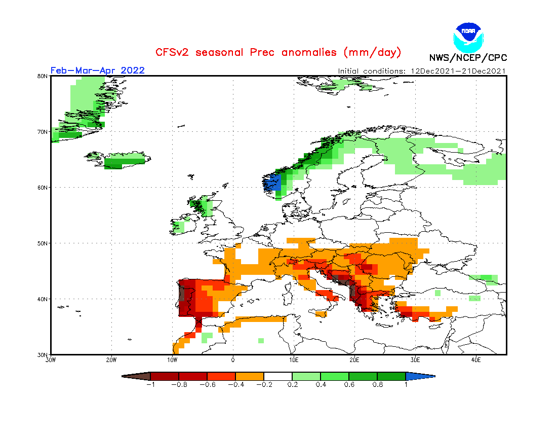
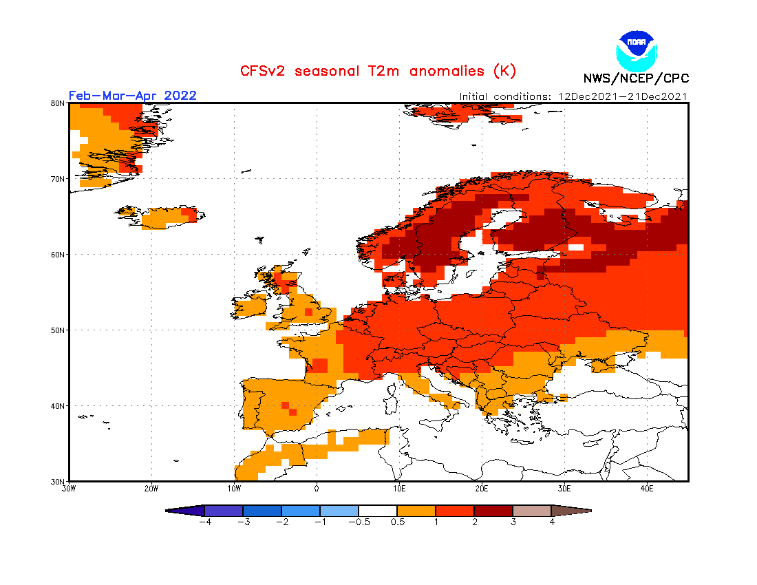
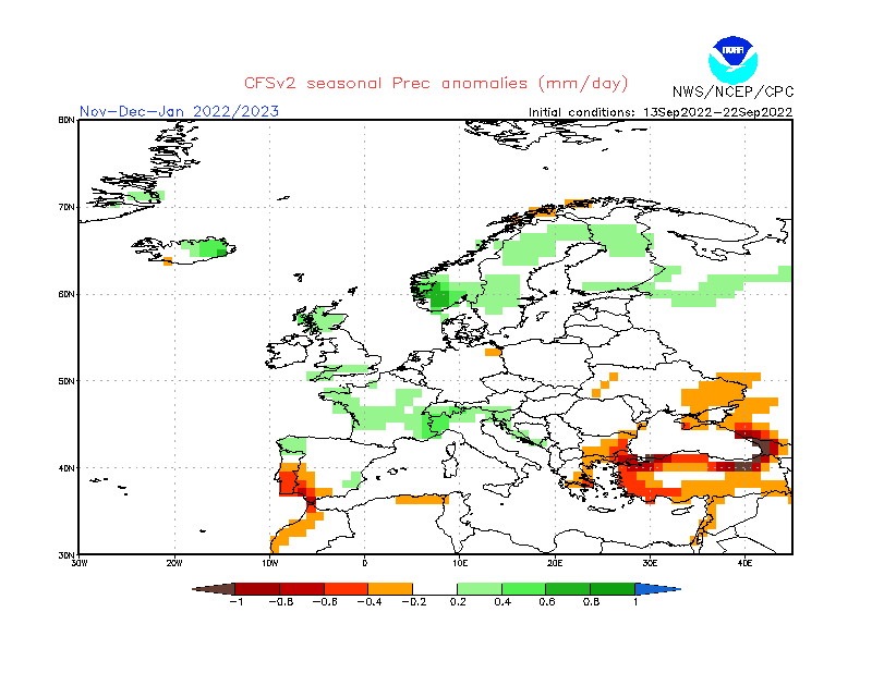
What do long-term weather maps indicate for the longer-term?
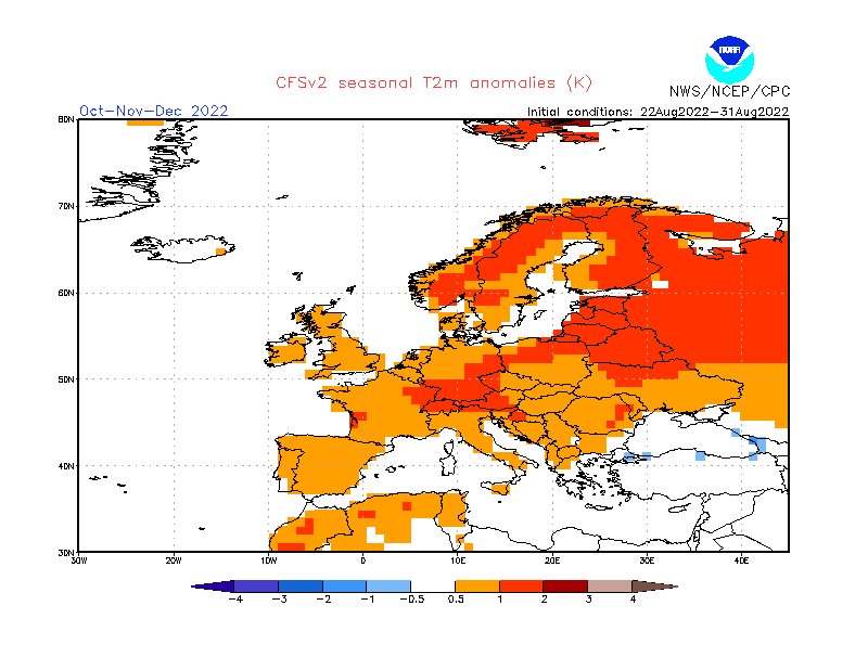
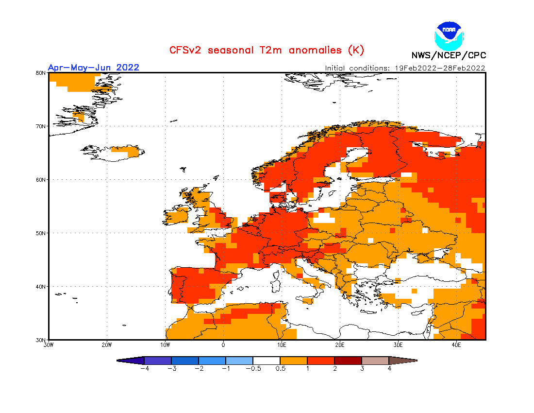
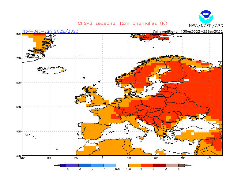
FURTHER OUTLOOK (TEMPERATURE) FOR NOVEMBER 2022 -DECEMBER 2022 – JANUARY 2023 Warmer than Average
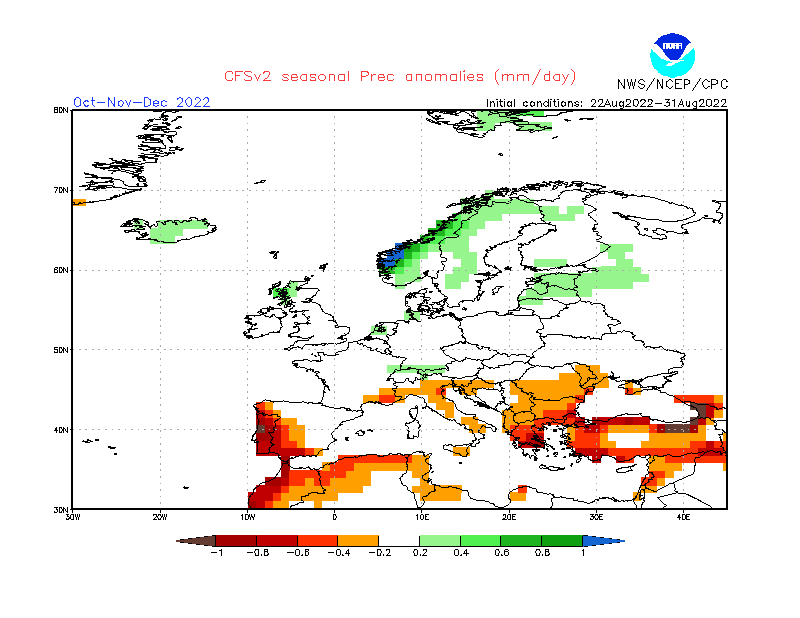
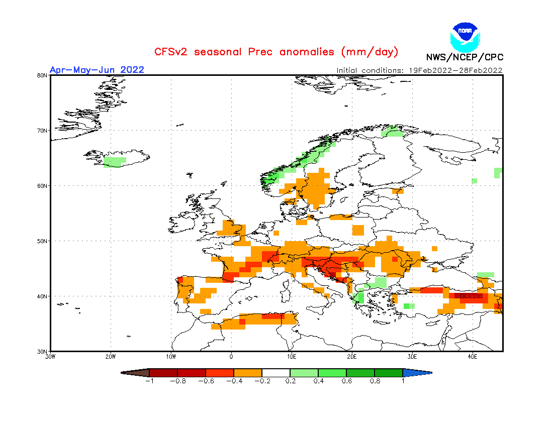
FURTHER OUTLOOK (PRECIPITATION) FOR NOVEMBER 2022 -DECEMBER 2022 – JANUARY 2023 Drier than Average*
* A ‘Drier than Average’ outlook means that maps are pointing towards below normal storm system activity around the central Mediterranean. How autumn and winter fare in terms of actual precipitation amounts measured locally depends on whether the rain-producing systems that form around the Maltese Islands affect land or not.
-
- Long-term seasonal model for temperature for November 2022/December 2022/January 2023
-
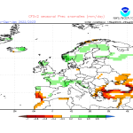
- Long-term seasonal model for precipitation for November 2022/December 2022/January 2023
Disclaimer: Specific details on the weather may only be given for a couple of days in advance. This long-term forecast is not meant to determine specific weather parameters at a point on the Maltese Islands. Instead, it looks at large scale weather patterns across Europe, and attempts to determine how these may influence the weather locally. Our levels of confidence in the forecast for the month ahead are fair. These are reasonably lower when it comes to the ‘Further Outlook’ section. Weather forecasts are an interpretation of possible weather events based on trends, maps and climate data at the time of the forecast, and as a result, weather predictions may always change over time. Maltese Islands Weather can never be held responsible for any direct, indirect, incidental, consequential, special or exemplary damages or even lost profit resulting from any use or misuse of this data. The user assumes the entire risk related to the use or misuse of this data.