September 2023 Weather Outlook (and more)
What is a typical September like according to climate statistics?
|
Mean Maximum Temperature |
Mean Minimum Temperature | Mean Temperature | Total Rainfall |
| 28.5°C | 21.6°C | 25.1°C |
55.8 mm |
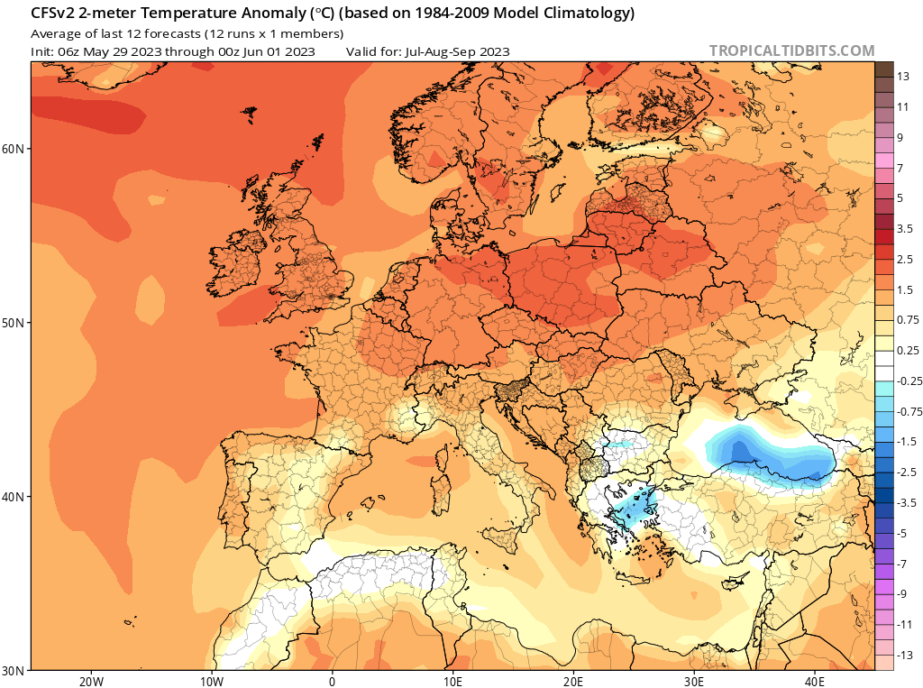
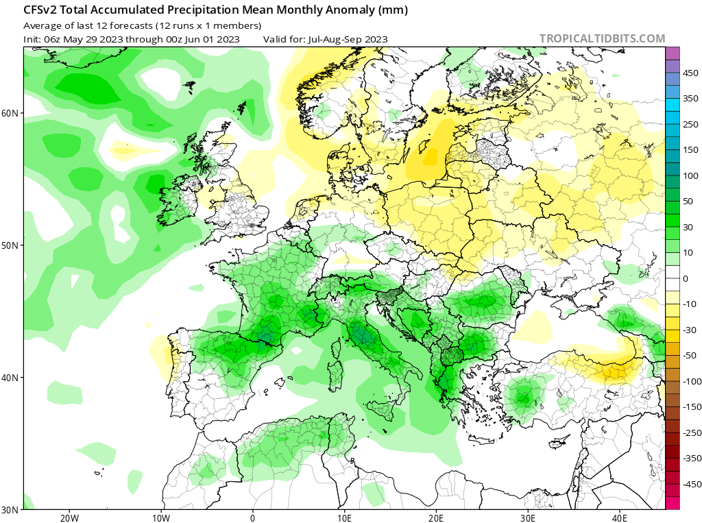
What do long-term weather maps indicate for September 2023?
September is the first month of meteorological autumn. September often brings an extension of summery conditions. Although heat spells in September rarely bring temperature at the same extreme levels as those of summer, the high relative humidity and prevailing southerly wind can make them feel far more uncomfortable. Long-term maps are in consensus that September 2023 is set to be wetter than average. A ‘Gregalata’ at the start of the month will be enough to push precipitation accumulations to above the climate norm. The possibility of further thunderstorms, particularly in the final weeks of the month, could add to this. A spell of fine weather, with characteristic summery weather, is likely around mid-month. The same long-term maps also agree that temperatures will overall be warmer than average. Temperatures are not expected to exceed 31°C. High levels of humidity, particularly after the ‘Gregalata’ of the first week or so, are likely to guarantee some clammy weather.
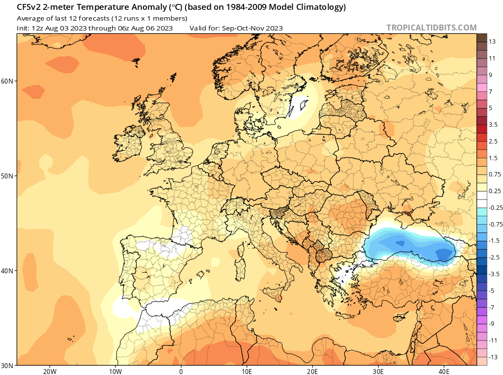
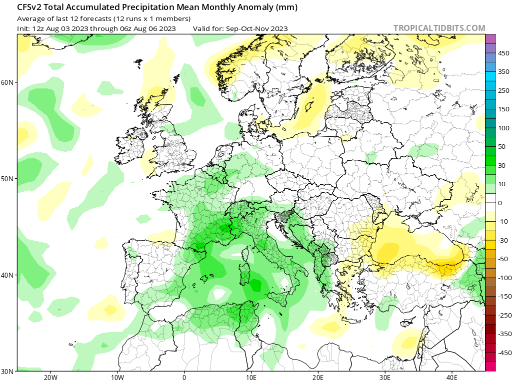
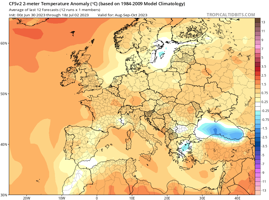
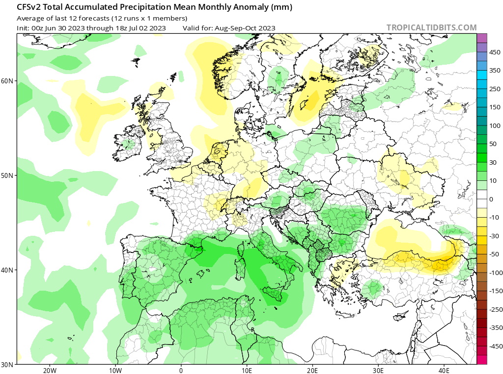
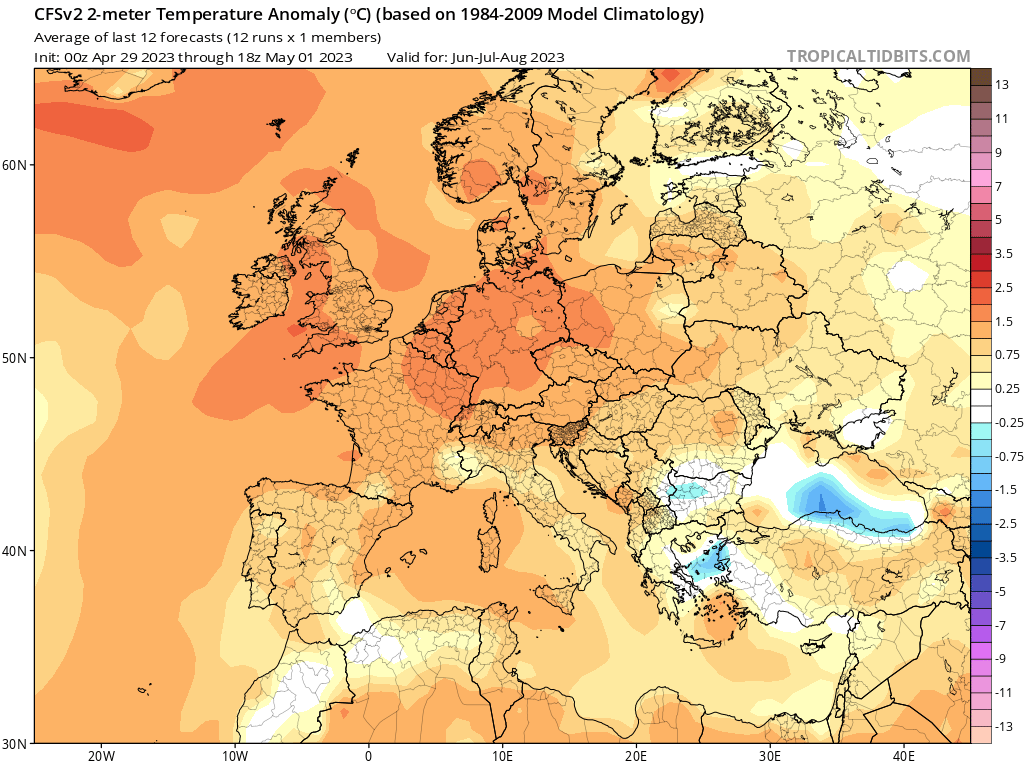
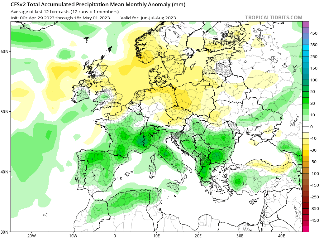
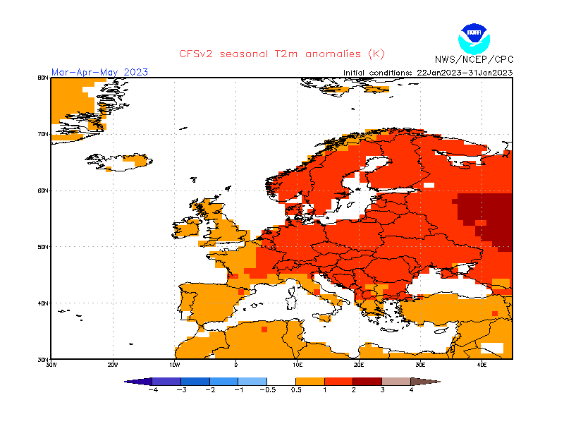
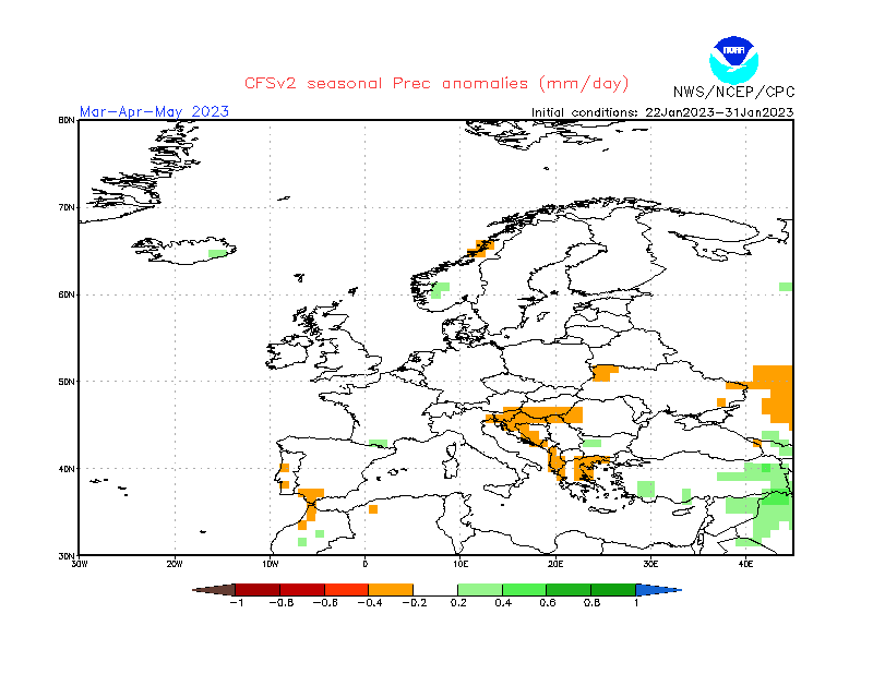
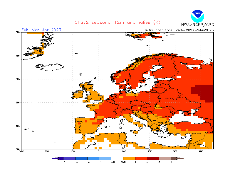
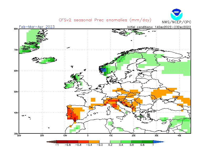
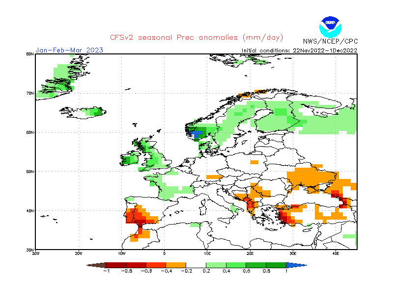
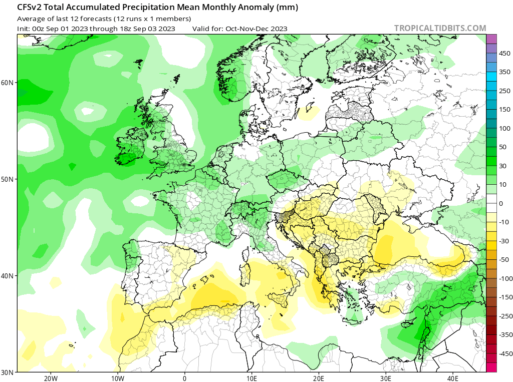
What do long-term weather maps indicate for the longer-term?
FURTHER OUTLOOK (TEMPERATURE) FOR OCTOBER 2023 – NOVEMBER 2023 – DECEMBER 2023 Average
FURTHER OUTLOOK (PRECIPITATION) FOR OCTOBER 2023 – NOVEMBER 2023 – DECEMBER 2023 Average* (Wetter than Average at first, turning into Drier than Average)
An ‘Average’ outlook means that maps are pointing towards normal storm system activity around the central Mediterranean. How the seasons fare in terms of actual precipitation amounts measured locally depends on whether the rain-producing systems that form around the Maltese Islands affect land or not.
-
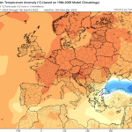
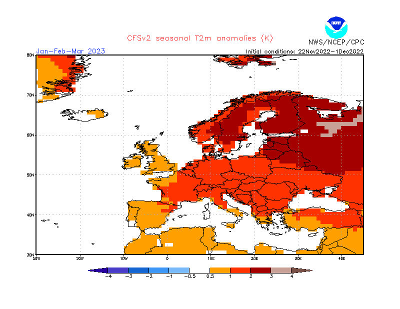
- Long-term seasonal model for temperature October 2023/November 2023/December 2023

-
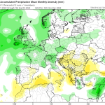
- Long-term seasonal model for temperature for October 2023/November 2023/December 2023
Disclaimer: Specific details on the weather may only be given for a couple of days in advance. This long-term forecast is not meant to determine specific weather parameters at a point on the Maltese Islands. Instead, it looks at large scale weather patterns across Europe, and attempts to determine how these may influence the weather locally. Our levels of confidence in the forecast for the month ahead are fair. These are reasonably lower when it comes to the ‘Further Outlook’ section. Weather forecasts are an interpretation of possible weather events based on trends, maps and climate data at the time of the forecast, and as a result, weather predictions may always change over time. Maltese Islands Weather can never be held responsible for any direct, indirect, incidental, consequential, special or exemplary damages or even lost profit resulting from any use or misuse of this data. The user assumes the entire risk related to the use or misuse of this data.