Learn About The Weather

Learn About The Weather

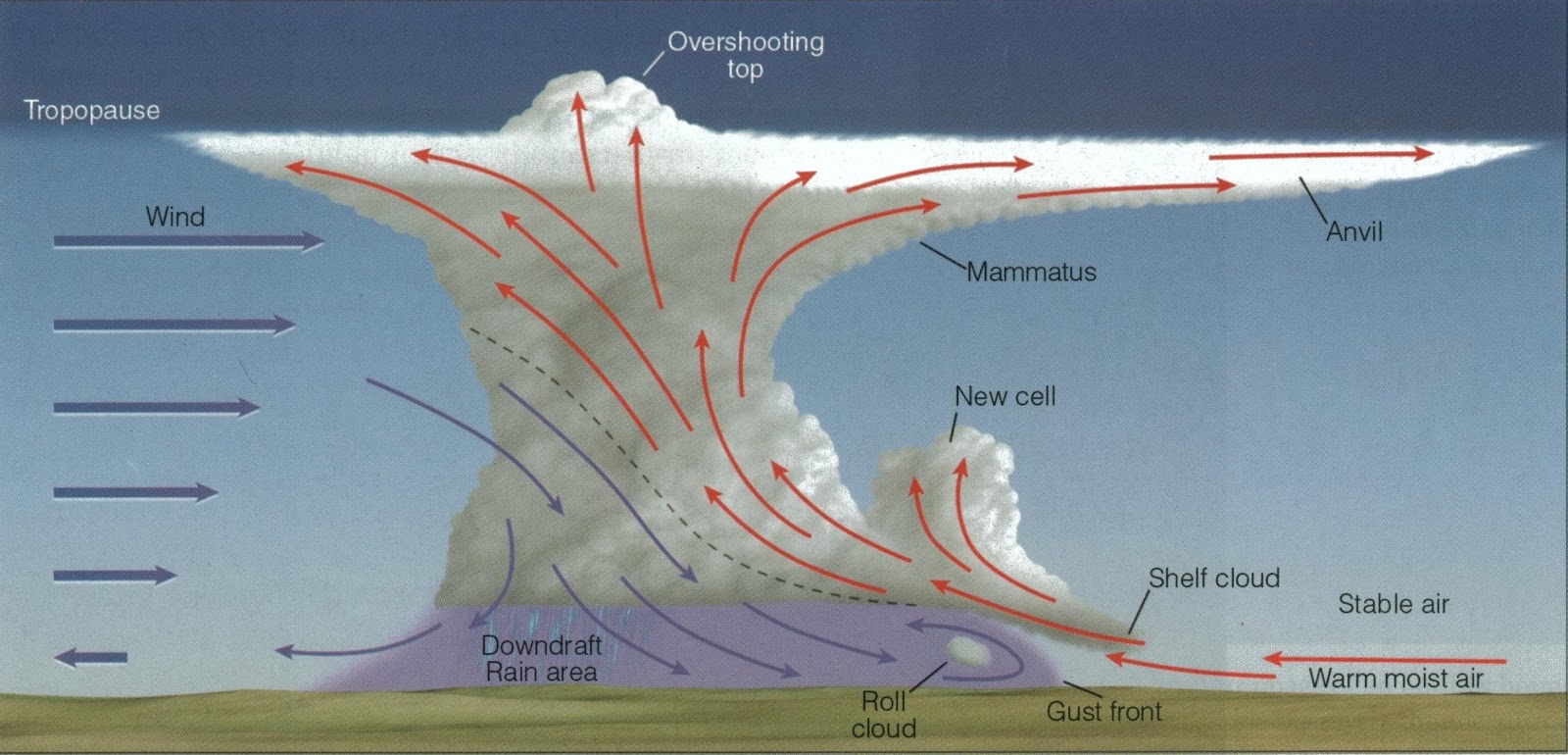
What is an anticyclone?

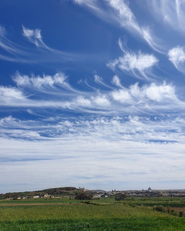
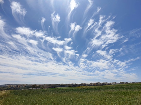
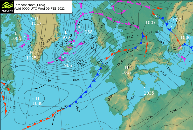
The Maltese Islands are currently experiencing an extended dry spell. Most days are featuring plentiful sunshine with light and variable winds. On days like these, temperatures are relatively warm by day, but can be rather cool at night. These weather conditions, which seem to persist for long, are the result of an anticyclone spanning the Mediterranean and much of continental Europe.

A high pressure system, also known as an anticyclone, occurs when the weather is dominated by stable conditions. In an anticyclone, the air is descending, forming an area of high pressure at the surface. Because of these stable conditions, cloud formation is inhibited, so the weather is usually settled with only small amounts of cloud cover. The lack of cloud allows the sun to shine brightly without interruption, allowing heat to accumulate during the day. This leads to warm daytime highs. At night, however, the same lack of cloud allows the heat accumulated during the day to escape into space. The result are cool nighttime lows. A distinct product of anticyclonic conditions is the formation of dew. Dew is water in the form of droplets that appears on exposed surfaces in the morning or evening due to the process of condensation. On a cold and clear night, the ground is cooled as it radiates energy into space. The air near the ground also cools and if the dew point is reached, water vapour condenses onto surfaces near the ground. If the temperature is above freezing, dew is formed. If the temperature is below freezing, frost is formed. Sometimes, mist or fog patches are formed. Both are the product of the same process. The only contrast between the two is that fog reduces visibility to less than 1 kilometre, whereas mist causes lesser impairment of visibility. Mist and fog form when the difference between the air temperature and dew point is less than 2.5°C. For mist or fog to form there must be water vapour present in the air. There are several ways by which water vapour is added to the air. In the dry season, water vapour is derived by the evaporation from the surface of the sea and transpiration of plants. In the wet season, recent precipitation adds to this. When the air becomes saturated, the water vapour condenses to form mist or fog. Radiation is the most common form of fog on days with anticyclonic conditions. Radiation fog is formed by the cooling of land after sunset by infrared thermal radiation in calm conditions with a clear sky. The cooling ground then cools adjacent air by conduction, causing the air temperature to fall and reach the dew point, forming fog. Radiation fog occurs at night, and often does not last long after sunrise. It is the thin wisp of ‘cloud’ often seen on low plains before dawn.

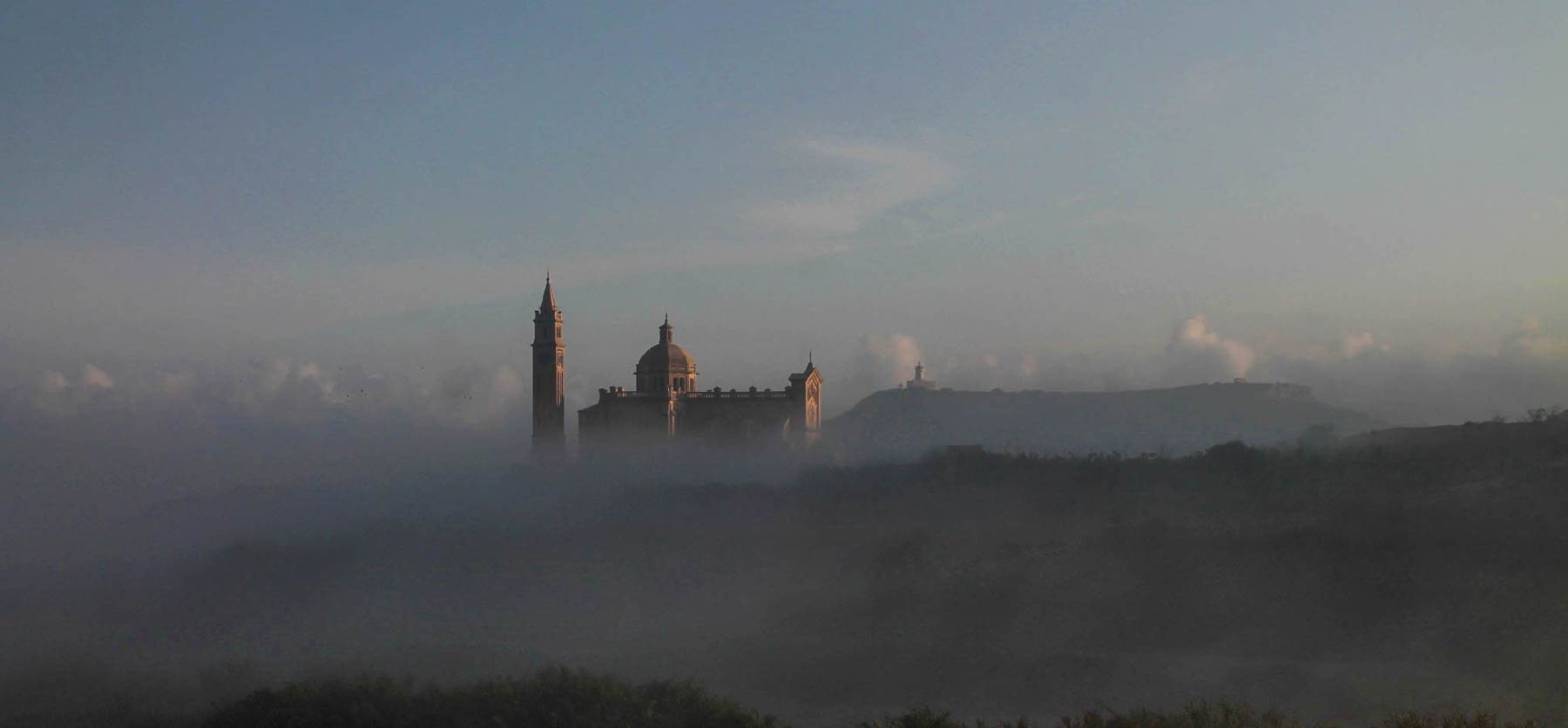
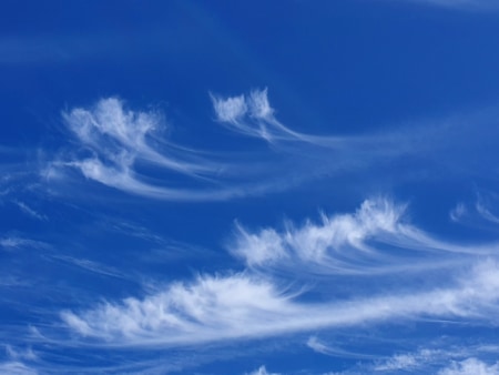
Mist or fog patches are a typical feature of anticyclonic conditions.

The graph below is typical of anticyclonic conditions. The temperature falls gradually overnight, reaching its coolest point just before dawn. It starts warming up gradually in the morning, as soon as the sun starts rising. It reaches its maximum by late in the morning. The temperature plateaus till late in the afternoon. It starts cooling down gradually again by sunset. Another interesting point is the wind speed behavior. It picks up by day, but dies down at night. The reason behind this is the sun. As the ground heats, the surface layer of air also heats. As the surface layer warms up, it becomes buoyant, and begins to rise polska-ed.com. The cooler air aloft sinks to replace the rising air, forming a circulation. As the sun sets, the ground cools rapidly, bringing this circulation to a stop.

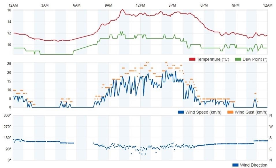
A graph depicting weather station readings on a typical day characterized by anticyclonic conditions.

Learn About The Weather

Graupel (a.k.a. snow pellets or soft hail)

Before any cold snap, we’re often asked if the Maltese Islands could get any snow. The answer to this question is a convincing “No”. This is because of two reasons: the air temperature is not cold enough and the sea’s moderating affect (being a warm 16°C) doesn’t permit any falling snow to reach the ground anywhere across the Maltese Islands. Occasionally, we still experience a very interesting phenomenon, however. This is the occurrence of graupel (a.k.a. soft hail or snow pellets), and is likely to occur at some point during an outbreak of Arctic air across the central Mediterranean. This is a form of precipitation which resembles crumbled polystyrene (jablo) that forms when supercooled droplets of water are collected and freeze on a falling snowflake, forming a 2-5 mm ball of rime. They fall gently like snow, so it’s easy to tell hail and graupel apart. They are most likely in the colder early morning hours, before the sun’s rays start heating the ground, and only occur in very brief and localized ‘showers’.

Learn About The Weather

The impact of Covid-19 on weather forecast accuracy

A decrease in commercial airline flights because of Covid-19 has fundamentally affected meteorologist’s capacity to precisely predict the weather. All around the globe, studies have revealed that forecast accuracy plummeted since March. This sharp decrease in forecast precision coincides with when planes were grounded because of the pandemic. A few investigations analyzed weather predictions since March and compared them with the actual observed meteorological conditions. The disparity is clear. Forecasts are based partly on computer models. The accuracy of computer models depends on the data put into them. These incorporate aircraft, cruise ships, satellites, weather buoys, weather balloons, ground stations and radar. All sources rely upon each other, and none are dispensable. The Covid-19 pandemic greatly reduced the availability of information acquired from two of these sources: aircraft and cruise ships. Information from aircraft, for instance, includes some 13% of the information that goes into a regular computer model. Availability of these critical aircraft observations has reduced significantly since March, as a result of successive lockdowns and airport closures. The World Meteorological Organization (WMO) observed how these measures have eliminated some half to 75% of airplane observations internationally. As per the European Center for Medium-Range Weather Forecasts (ECMWF), if all flight information were to be eliminated, the precision of figure models would dip by some 15%. This would make little difference on most days, when the weather is not extreme. On days when severe weather is anticipated, however, a 15% decline in forecast accuracy could have dire consequences.

Let’s take the local scene as an example. To our south is war-torn Libya. With no established meteorological authority functioning there, data being fed to models specific for our area from the south is practically non-existent. Imagine what bigger impact a sharp decline in aircraft has had. Models specific for our region now rely on data inputted by the National Met Office at the Malta International Airport, ships traversing the central Mediterranean and meteorological authorities across southern Italy (specifically Sicily) and Tunisia. The fact that the Maltese Islands lie very close to a major shipping lane has helped mitigate the negative impact the loss of data has had on forecast accuracy.

Learn About The Weather

The potential effects of a very warm sea …

If you’ve noticed that the sea is not particularly refreshing, you’re not imagining it! The surface temperature around the Maltese Islands has peaked at 29⁰C. That is some 2⁰C warmer than average. It was this warm back in 2017. It may appear to be a marginal difference, but this difference in sea surface temperature is considered significant.

A very high sea surface temperature inhibits nighttime cooling in air temperatures. In fact, whilst daytime highs will continue to decline gradually, nighttime lows are anticipated to remain warmer than average in the long term. The coming nights will continue to feature 23⁰C to 25⁰C lows, some 2⁰C to 5⁰C warmer than the climate norm. The high sea surface temperature will also contribute to increased rates of evaporation, which in turn, will lead to increased humidity. The more humid the air is, the warmer and clammier it will feel. The high humidity may also have further implications on our weather in the autumn. As summer transitions into autumn, increasingly cooler air from over Europe will start infiltrating the central Mediterranean. The sharp difference between local and incoming air should destabilise the atmosphere above our islands more easily, possibly leading to the formation of more vigorous bad weather systems. In addition to this, a greater amount of moisture is available to be advected into these systems as a result of the very warm sea. One obvious product of this could be thunderstorms with intense rainfall. All this is purely a prediction based on science and history. As a result, it is imperative that you continue following our page to remain continuously up to date on the latest weather situation!

Current weather maps are indicating possible instability across the central Mediterranean Wednesday 02/09 and Thursday 03/09.  Summer will not be coming to an abrupt end, with the majority days in the coming weeks likely to see sunny to mainly sunny skies along with daytime highs of up to 32°C.

Learn About The Weather

Urban Heat Island Effect

The phrase ‘urban heat island effect’ was coined by scientists to describe the impact that urbanisation has on the climate of where humans live. Today, some 55% of the world’s population lives in urban areas. All these are subject to the urban heat island effect phenomenon. Felt particularly in summer, urban areas tend to be some 3°C to 4°C hotter than rural areas. Urban areas are covered mainly with concrete, metal and asphalt. These absorb heat more effectively at-casinos.com/. Rural areas, on the other hand, are covered mainly with fields, trees and soil. These absorb less of the  incoming solar radiation. As a result, urban areas are always hotter. The difference arises from the fact that materials commonly used in urban areas are better absorbents of heat, and have poor radiative properties (as they tend to absorb rather than reflect the incoming solar radiation) when compared to the land cover normally found in rural areas. The effects are pronounced more at night. The concrete, metal and asphalt in urban areas release the trapped heat slowly by night. The fields, trees and soil trap less heat, and release this more rapidly. As a result, urban areas are also far hotter than rural areas at night as well. The more intense traffic and a higher density of air conditioning units in urban areas adds to the heat. Levels of air pollution in cities are greater too. This enhances the greenhouse effect, and thus traps more heat, resulting in even hotter temperatures.

Apart from the obvious effect on temperature, the urban environment also has an impact on local wind patterns, the development of clouds and fog, relative humidity and precipitation. Urban areas covering a significant area have been linked to an increase in localised thunderstorms. This could be attributed to stronger convection because of an increase in temperature.

Measures to mitigate the urban heat island effect normally include the establishing of green roofs and the use of a lighter colour for surfaces.


Learn About The Weather

Summer solstice

The astronomical start of a season is based on the position of the Earth in relation to the Sun. The start of each season is marked by either a solstice (winter and summer) or an equinox (spring and autumn). A solstice takes place when the Sun reaches the most southerly or northerly point in the sky, while an equinox marks the point when the Sun passes over Earth’s equator.

The summer solstice occurs when one of the Earth’s poles, the north pole in the case of the Northern Hemisphere, has its maximum tilt towards from the Sun. It happens twice yearly, once in each hemisphere. The summer solstice is the day with the longest period of daylight and shortest night of the year https://polska-ed.com/kupic-generic-cialis/. The Sun is today at its highest daily maximum elevation in the sky. At the pole, there is continuous light around the summer solstice. The summer solstice marks the beginning of summer. Because of leap years, the dates of the equinoxes and solstices can shift by a day or two over time, causing the start dates of the seasons to shift too. For instance, this year, summer starts on Saturday, June 20th and not on Sunday, June 21st!

Since prehistory, the summer solstice has been seen as a significant time of year in many cultures, and has been marked by festivals and rituals. On the first day of each season, the rises in a particular alignment to the prehistoric temples of Ħaġar Qim and Mnajdra. They are so systematic that it is very probably that these orientations were intentional. In prehistory, the observation of the motion of celestial bodies was related to the changing season and times of planting and harvesting of crops.

From tomorrow onward, the length of the day will start decreasing again! For those of you who love winter, see this day as the start of the road to winter.


Learn About The Weather

Rip Currents

A fine day with a light to moderate wind. The sea is not too rough. You’re off for a day at the beach. No matter how calm the sea is, always keep a look out for potential rip currents. What are rip currents? A rip is a strong, localised, and narrow current of water which moves directly away from the shore, cutting through the lines of breaking waves like a river running out to sea, and is strongest near the surface of the water at-casinos.com. A rip current manifests itself as a noticeable break in the pattern of the waves. The water often looks flat at the rip, in contrast to the lines of breaking waves on either side of the rip. Rip currents are a potential source of danger for people in shallow water with breaking waves. They can flow at up to 2.5 metres per second and may extend for a long distance. They are however, very narrow. What to do if you are caught in a rip current? You will feel that a current is pushing you out to sea. Do not panic. Do not try to swim against the current. Instead, swim slowly towards the side of the current, parallel to the beach. As you exist the current, you will feel its power declining. Trying to swim against the current will leave you exhausted and unable to stay afloat. It is very important to share this information with family and friends, so they too can be safer on a day on the beach this summer. Make sure to remind your kids about it when visiting the beach.

Learn About The Weather

The Sun: Its Good and Bad

The Sun

The Sun is the center of our solar system, around which all planets orbit. Like all stars, the Sun’s a giant ball of super heated hydrogen gas. Comprising 98.6 percent of the solar system’s total mass, the Sun provides nearly all of the Earth’s energy as electromagnetic radiation. The absorption, reflection and redistribution of this energy from the Sun shapes the weather and climate of our planet. The Sun’s surface is not firm like the Earth’s; but is composed of churning active gases, hot enough to vaporize any solid. The energy produced and emitted by the Sun provides warmth and light for all planets. Containing only seven percent of the Sun’s volume, but half its mass, the inner core fuels the star with nuclear fusion.


UV Index

This index is an international standard measurement of the strength of Ultraviolet (UV) radiation at a particular place and time. The purpose of the UV Index is to help people effectively protect themselves from UV radiation, which has health benefits in moderation but in excess causes sunburn, skin aging, DNA damage, skin cancer, eye damage such as cataracts and immunosuppression.

Some Negative Impacts

Most are familiar with the harmful effects associated with exposure to direct sunlight. Like many things in life, too much sun may be detrimental to one’s health.

  • Long-term, unprotected exposure to direct sunlight can damage the retina. This may cause blurred vision and possibly cataracts in the long run.
  • Too much sunshine can cause excessive sweating. Sweating leads to the loss of water and essential salts in the body. This may result in heat exhaustion. If heat exhaustion is left untreated, it can lead to heat stroke. Heat stroke is the most serious heat-related illness and can be life-threatening. Heat stroke causes the temperature of the body to rise quickly.
  • Sunburns are widely recognised as one of the most common negative effects of too much sun exposure. The symptoms of sunburn do not usually appear until about four or five hours after the sun exposure occurs.
  • The worst consequence of long-term exposure to the sun is the development of skin cancer. Because the sun damage to the skin develops over years, the older you are, the greater the risk of developing skin cancer. After years of exposure to the sunlight, specialists look for three common types of skin cancer.
  • Sun exposure is a significant factor in the development of wrinkles. UV radiation damages collagen and elastic tissue in the skin, so it becomes fragile and does not spring back into shape, causing sagging. UV light exposure also causes white and dark spots on the skin, as it damages the surface cells.

Some Positive Impacts

Very often, the Sun has the reputation for only leaving a negative impact on our health, when in fact, its benefits are many. Like many things in life, sunshine should be enjoyed in moderation.

  • It enhances your mood. Being in the Sun can help people feel better and more energetic. Sunlight increases the levels of serotonin in the brain. Serotonin is associated with improved mood. Not surprisingly, serotonin levels are highest in the summer months.
  • It helps relieve stress. Life in itself induces stress. Be it through work, family or health related issues. Stress can be relieved in various ways. One of them is through exposure to sunlight.
  • It helps treat Seasonal Affective Disorder. In some people, the lack of sunlight in winter can trigger depression. Symptoms include bad moods, difficulty making and keeping friends, overeating, tiredness and sleeping far too much.
  • It improves sleep quality. Exposure to sunlight impacts how much melotonin your body produces. Melotonin is the chemical that tells your brain when it is time to sleep. With a lack of sunlight, your body produces far more melotonin than is needed. Hence, you feel tired and ready to sleep more often and earlier.
  • It provides you with Vitamin D. It is often referred to as the sun vitamin. Vitamin D is involved in maintaining a healthy body. One way you can get this vitamin is exposure to the ultraviolet light from the sun.

You don’t need much time in the sun to take advantage of these benefits. Only 15 to 30 minutes of sun exposure is all you need.

Learn About The Weather

Varieties of Cirrus

The high, white, delicate cirrus cloud species occur generally in curved filaments or straight lines. Like all cirrus clouds, they are composed entirely of gently falling ice crystal, at altitudes above circa 6 kilometres. They are usually formed when layers of relatively dry air ascend in the upper troposphere, the small amount of water vapour then subliming into ice when it meets its subzero dew point. Sublimation is the process of transforming directly from solid to a gas, or vice versa, with no intermediate liquid state. These smaller kinds of lofty cirrus cloud usually appear on their own in a dry blue sky, since if the air were more humid, other types of cloud would have formed at lower levels. If that is the case, and the cirrus does not begin to spread, then fine weather may well continue for a while, but if the cirrus begins to increase its cover, thickening or spreading out horizontally, then it means that a warm front is on its way, pushing up moist air ahead of itself, and causing the weather to take an imminent turn for the worse. Sailors have long viewed the growth of comma-shaped cirrus clouds as a useful ‘wind warning’. These are the fibratus and uncinus species of Cirrus.

Cirrus spissatus is a thick, dense species of cirrus cloud, which can often appear to dominate large areas of sky polska-ed.com. Such thickened or actively changing cirrus species will often appear in the vanguard of an approaching warm front, as a parcel of moist air is forced up over the shall0w wedge of cooler air that it encounters, causing high clouds to form in the upper atmosphere. It often means that wet or stormy weather will be on its way some time over the following 48 hours. The castellanus and floccus species exhibit turretty sproutings or ragged patches, and often feature trailing filaments below the main cloud. These tendrils form when the descending ice crystals end up in a deep layer of cold air that is moving at stable speed, causing them to be spread across the sky, sometimes for enormous distances. Although these clouds are composed of gently falling ice crystals, and therefore precipitating, they rarely produce any kind of precipitation that reaches the ground, although they often exhibit virga. Virga are trails of descending snow or rain that evaporate in the warm lower air, long before they are able to reach the surface.


Learn About The Weather

Cumulonimbus Incus

The anvil-shaped summit of a large cumulonimbus cloud, the incus, is an icy canopy that can grow to enormous heights above the main body of the cloud, spreading out laterally as it encounters the tropopause – the atmospheric boundary separating the troposphere from the stratosphere  – to create the characteristic flattened thunderhead seen here. It can be smooth in appearance, especially at a distance, but it is usually highly vibrous and striated, composed of billions of ice crystals borne aloft by vigorous upward convection.

An incus is an indication that thunderstorm is in its mature stage, and is therefore capable of:

The incus can sometimes separate itself from the main storm cloud, preceding it by many kilometers, even producing cloud-to-ground lightning in the apparent absence of the main storm cloud, If, as sometimes happens, the main cumulonimbus cloud decays or rains itself out, leaving the anvil behind on its own, the resulting cloud is known as cirrus spissatus cumulonimbogenitus.

Photo: Nicola Magri