
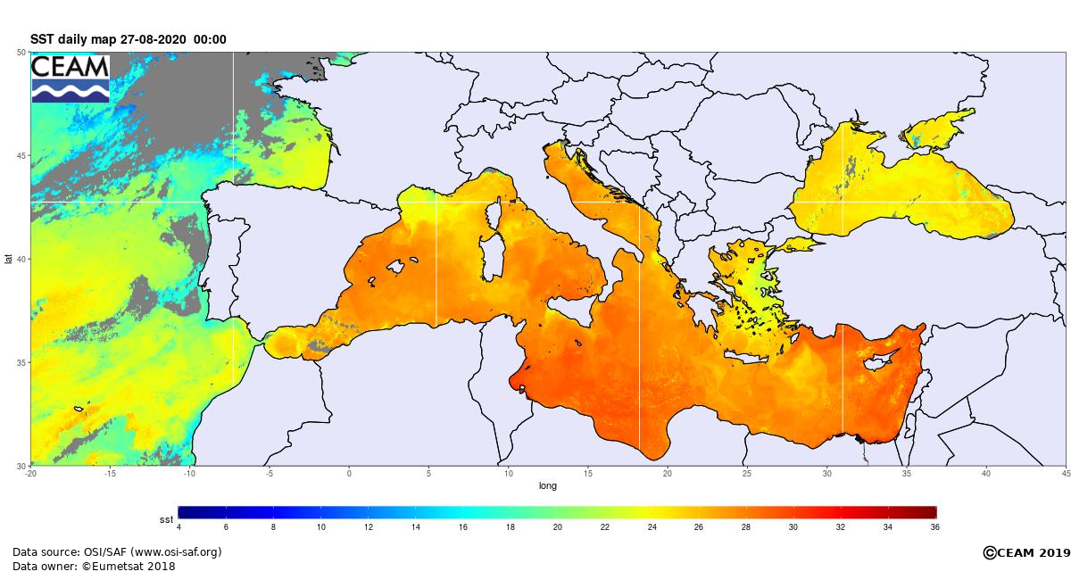
If you’ve noticed that the sea is not particularly refreshing, you’re not imagining it! The surface temperature around the Maltese Islands has peaked at 29⁰C. That is some 2⁰C warmer than average. It was this warm back in 2017. It may appear to be a marginal difference, but this difference in sea surface temperature is considered significant.
A very high sea surface temperature inhibits nighttime cooling in air temperatures. In fact, whilst daytime highs will continue to decline gradually, nighttime lows are anticipated to remain warmer than average in the long term. The coming nights will continue to feature 23⁰C to 25⁰C lows, some 2⁰C to 5⁰C warmer than the climate norm. The high sea surface temperature will also contribute to increased rates of evaporation, which in turn, will lead to increased humidity. The more humid the air is, the warmer and clammier it will feel. The high humidity may also have further implications on our weather in the autumn. As summer transitions into autumn, increasingly cooler air from over Europe will start infiltrating the central Mediterranean. The sharp difference between local and incoming air should destabilise the atmosphere above our islands more easily, possibly leading to the formation of more vigorous bad weather systems. In addition to this, a greater amount of moisture is available to be advected into these systems as a result of the very warm sea. One obvious product of this could be thunderstorms with intense rainfall. All this is purely a prediction based on science and history. As a result, it is imperative that you continue following our page to remain continuously up to date on the latest weather situation!
Current weather maps are indicating possible instability across the central Mediterranean Wednesday 02/09 and Thursday 03/09. Summer will not be coming to an abrupt end, with the majority days in the coming weeks likely to see sunny to mainly sunny skies along with daytime highs of up to 32°C.
0 comments
Write a comment