
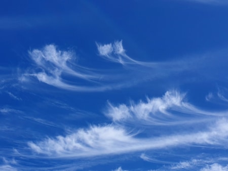
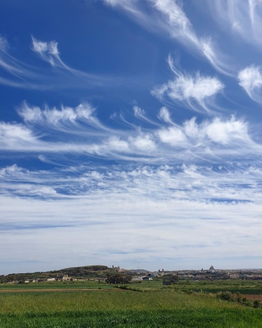
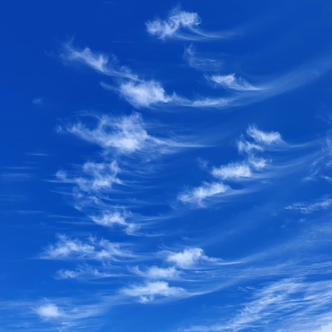
The high, white, delicate cirrus cloud species occur generally in curved filaments or straight lines. Like all cirrus clouds, they are composed entirely of gently falling ice crystal, at altitudes above circa 6 kilometres. They are usually formed when layers of relatively dry air ascend in the upper troposphere, the small amount of water vapour then subliming into ice when it meets its subzero dew point. Sublimation is the process of transforming directly from solid to a gas, or vice versa, with no intermediate liquid state. These smaller kinds of lofty cirrus cloud usually appear on their own in a dry blue sky, since if the air were more humid, other types of cloud would have formed at lower levels. If that is the case, and the cirrus does not begin to spread, then fine weather may well continue for a while, but if the cirrus begins to increase its cover, thickening or spreading out horizontally, then it means that a warm front is on its way, pushing up moist air ahead of itself, and causing the weather to take an imminent turn for the worse. Sailors have long viewed the growth of comma-shaped cirrus clouds as a useful ‘wind warning’. These are the fibratus and uncinus species of Cirrus.
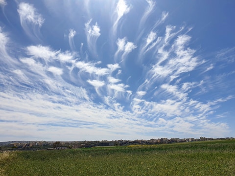
Cirrus spissatus is a thick, dense species of cirrus cloud, which can often appear to dominate large areas of sky polska-ed.com. Such thickened or actively changing cirrus species will often appear in the vanguard of an approaching warm front, as a parcel of moist air is forced up over the shall0w wedge of cooler air that it encounters, causing high clouds to form in the upper atmosphere. It often means that wet or stormy weather will be on its way some time over the following 48 hours. The castellanus and floccus species exhibit turretty sproutings or ragged patches, and often feature trailing filaments below the main cloud. These tendrils form when the descending ice crystals end up in a deep layer of cold air that is moving at stable speed, causing them to be spread across the sky, sometimes for enormous distances. Although these clouds are composed of gently falling ice crystals, and therefore precipitating, they rarely produce any kind of precipitation that reaches the ground, although they often exhibit virga. Virga are trails of descending snow or rain that evaporate in the warm lower air, long before they are able to reach the surface.
0 comments
Write a comment