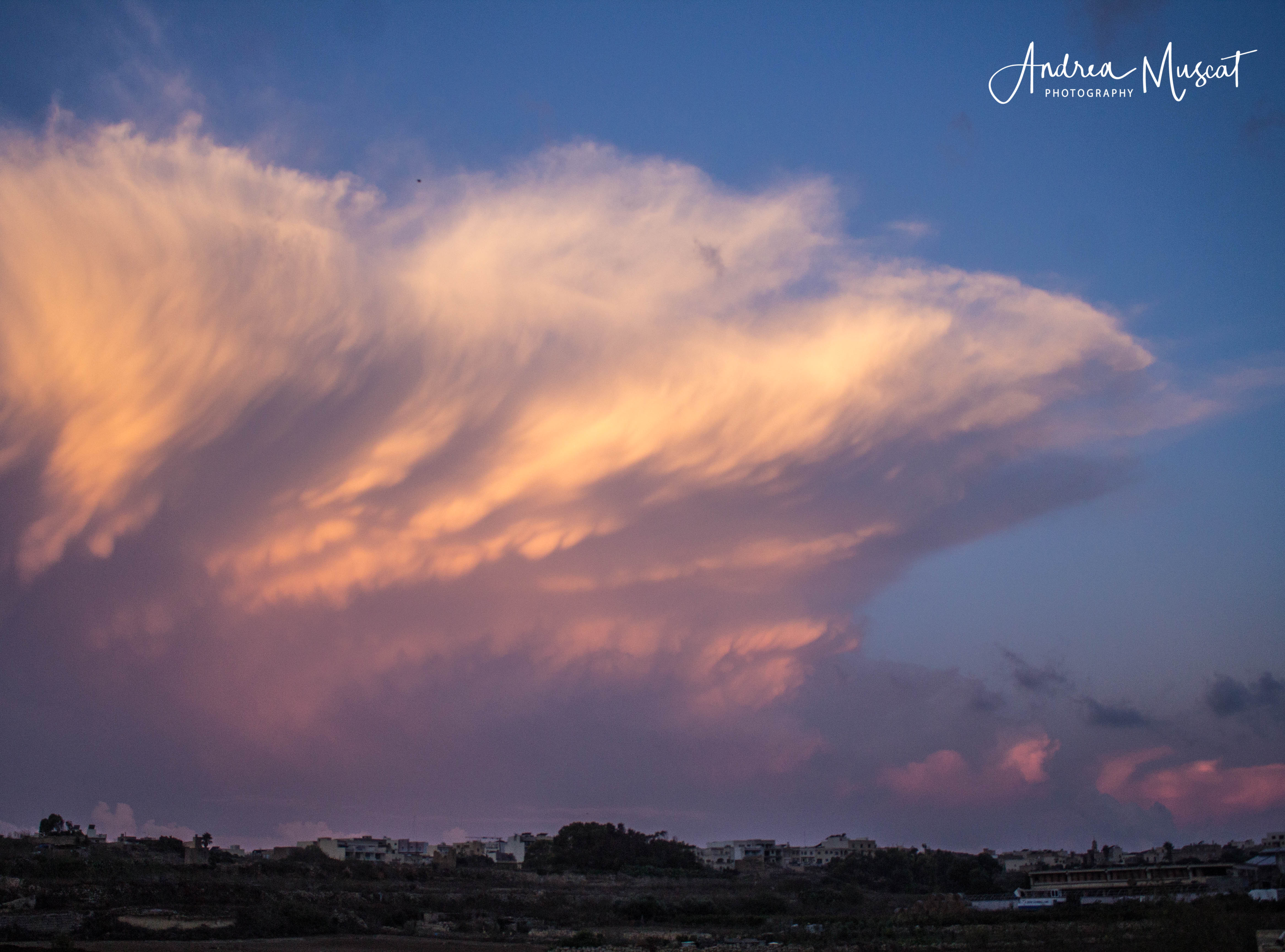
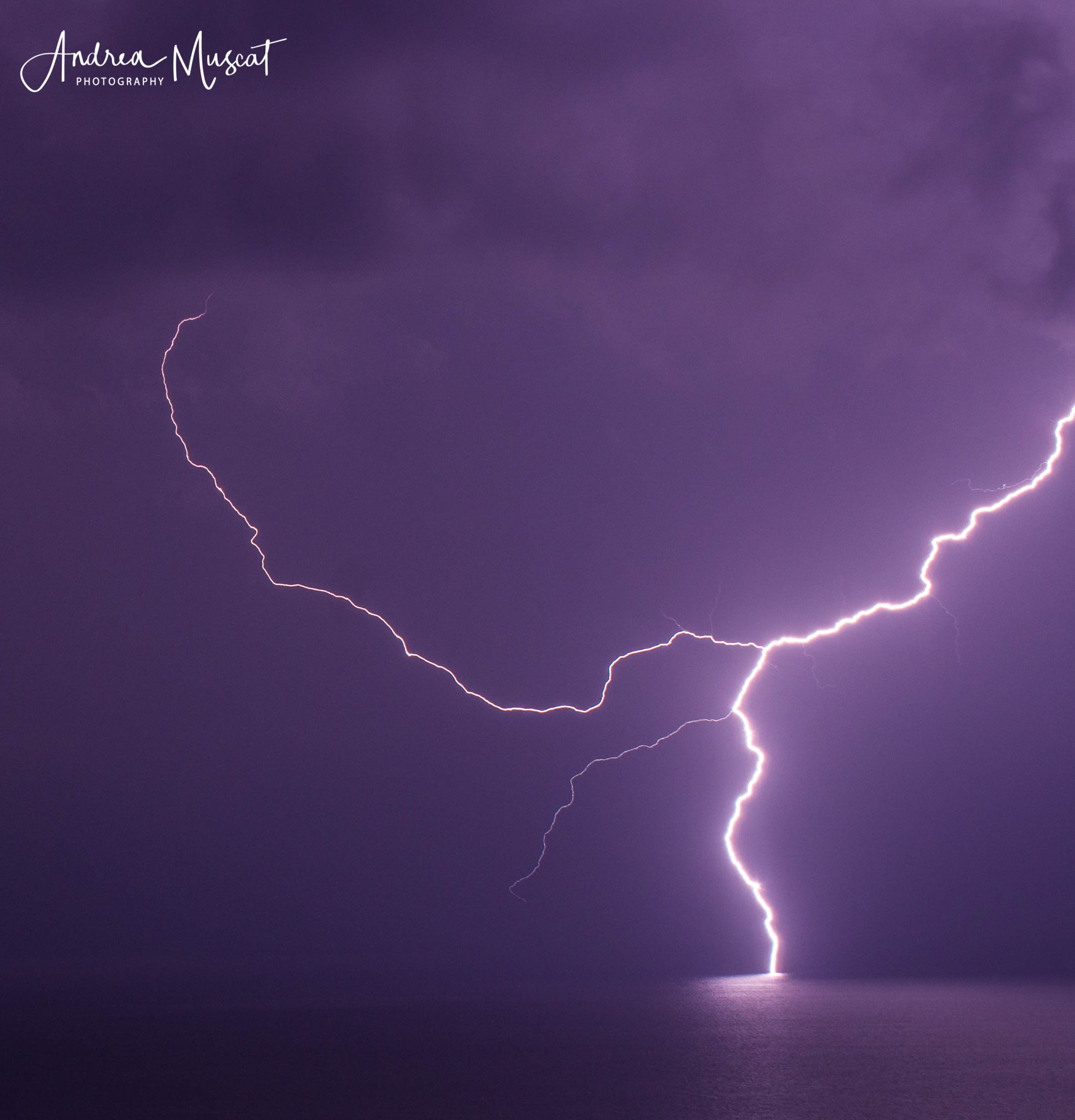
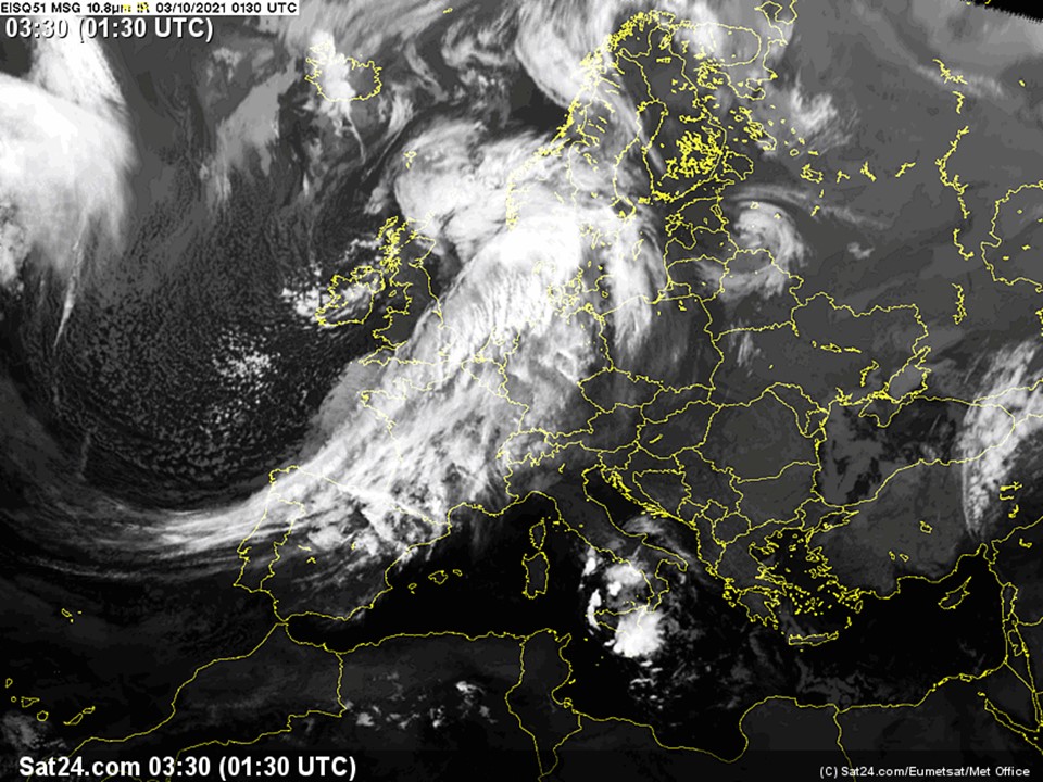
The sea surface temperature around the Maltese Islands this summer peaked at 30⁰C, a full 3⁰C warmer than the average. The high sea surface temperature contributed to increased rates of evaporation, which in turn, lead to an increase in humidity levels. From 1/10 through to 3/10, a series of heavy thunderstorms occurred around the central Mediterranean. A short-wave upper-level low pressure system passed across our region bringing relatively cold air over a very warm sea, creating a great deal of instability. In addition to this, a greater amount of moisture was available to be advected into these thunderstorms. The end product were thunderstorms with intense rainfall.
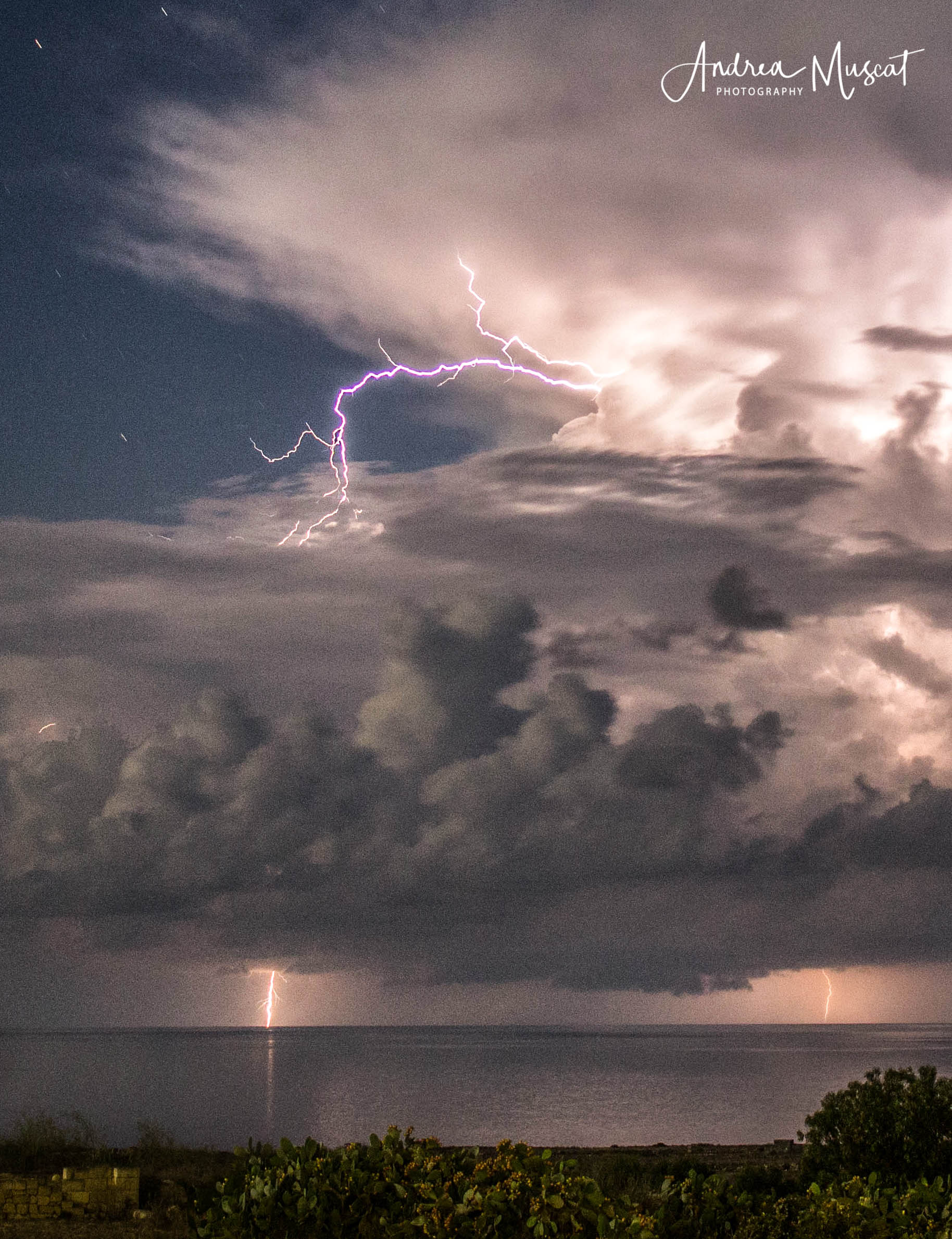
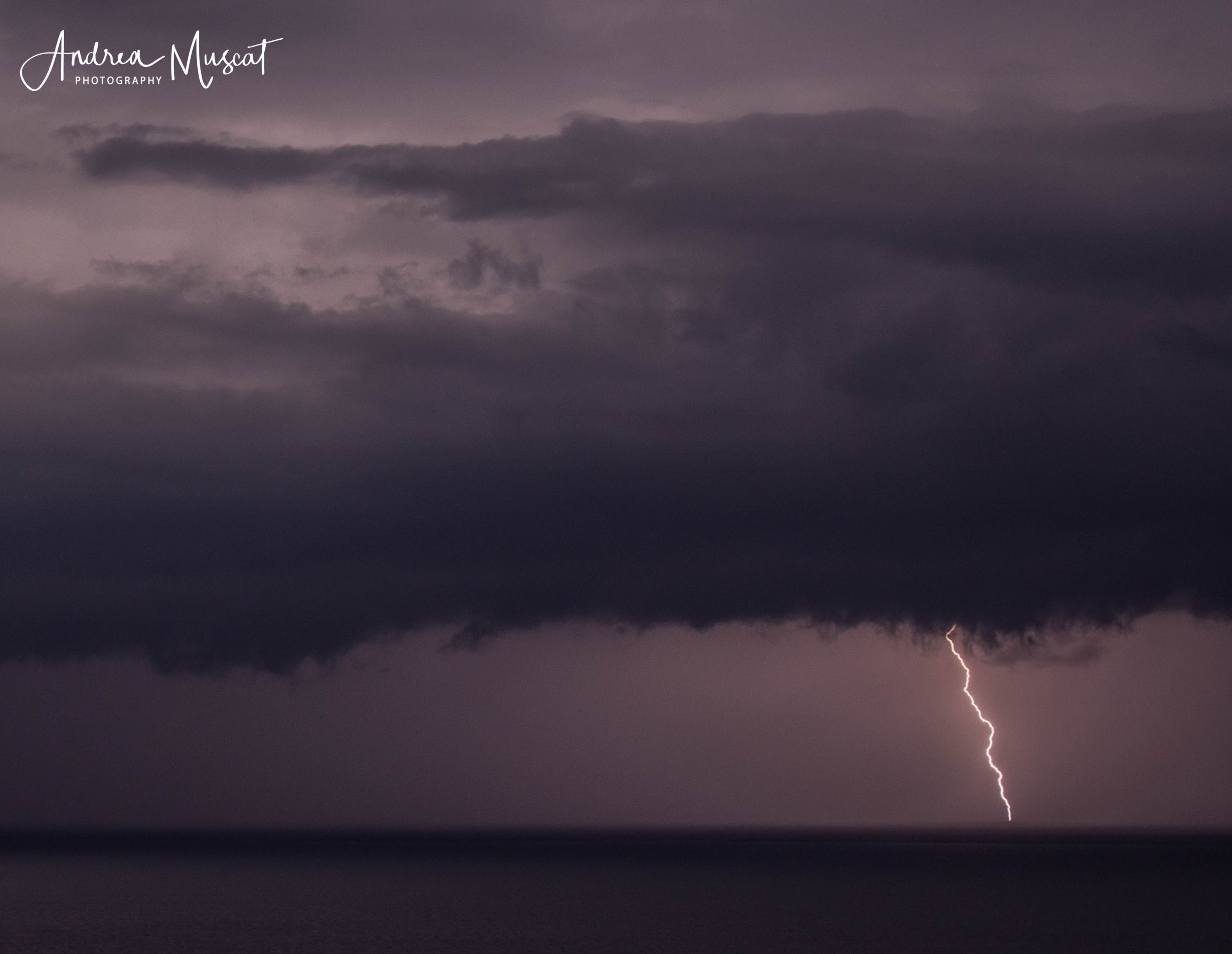
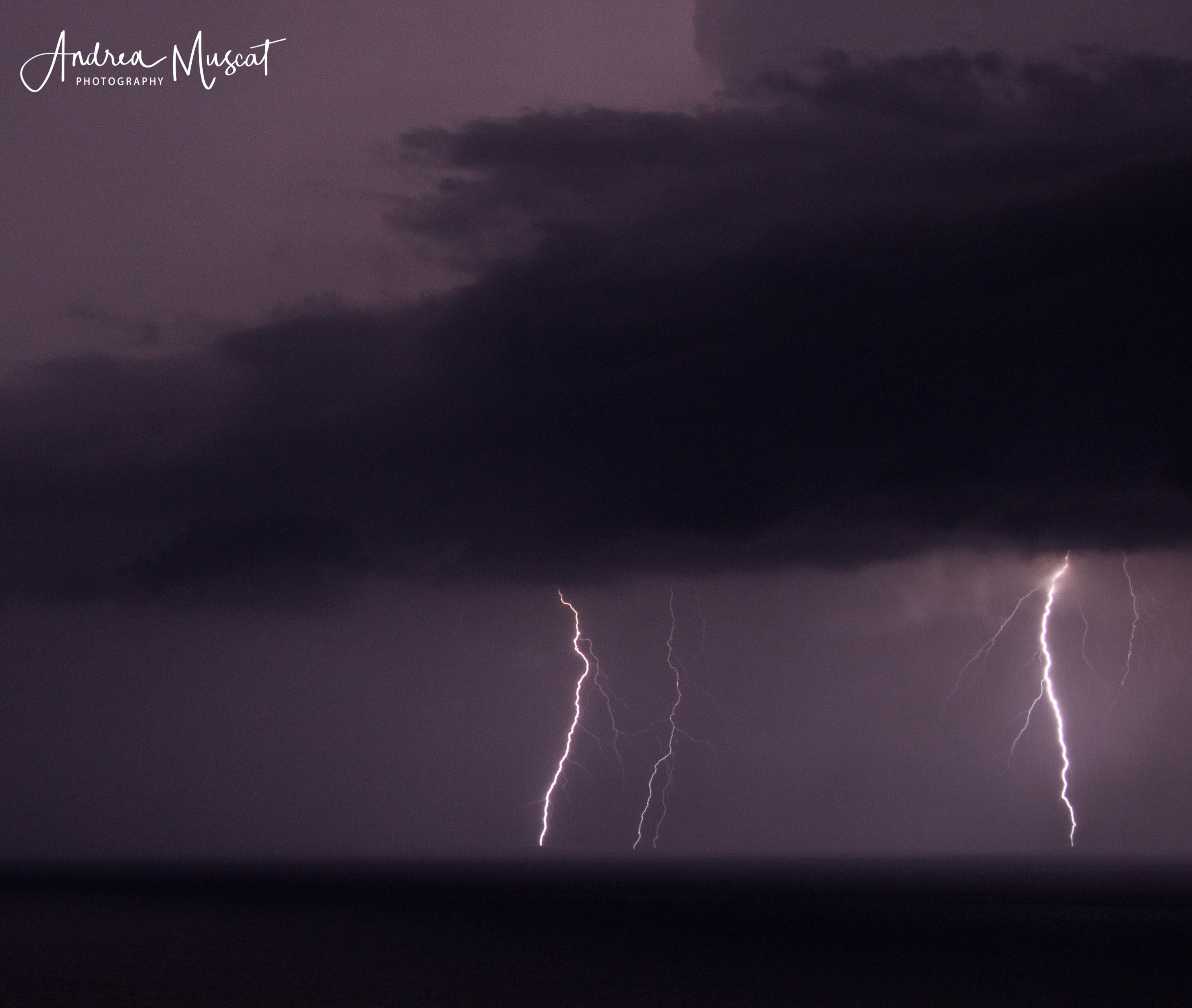
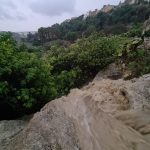
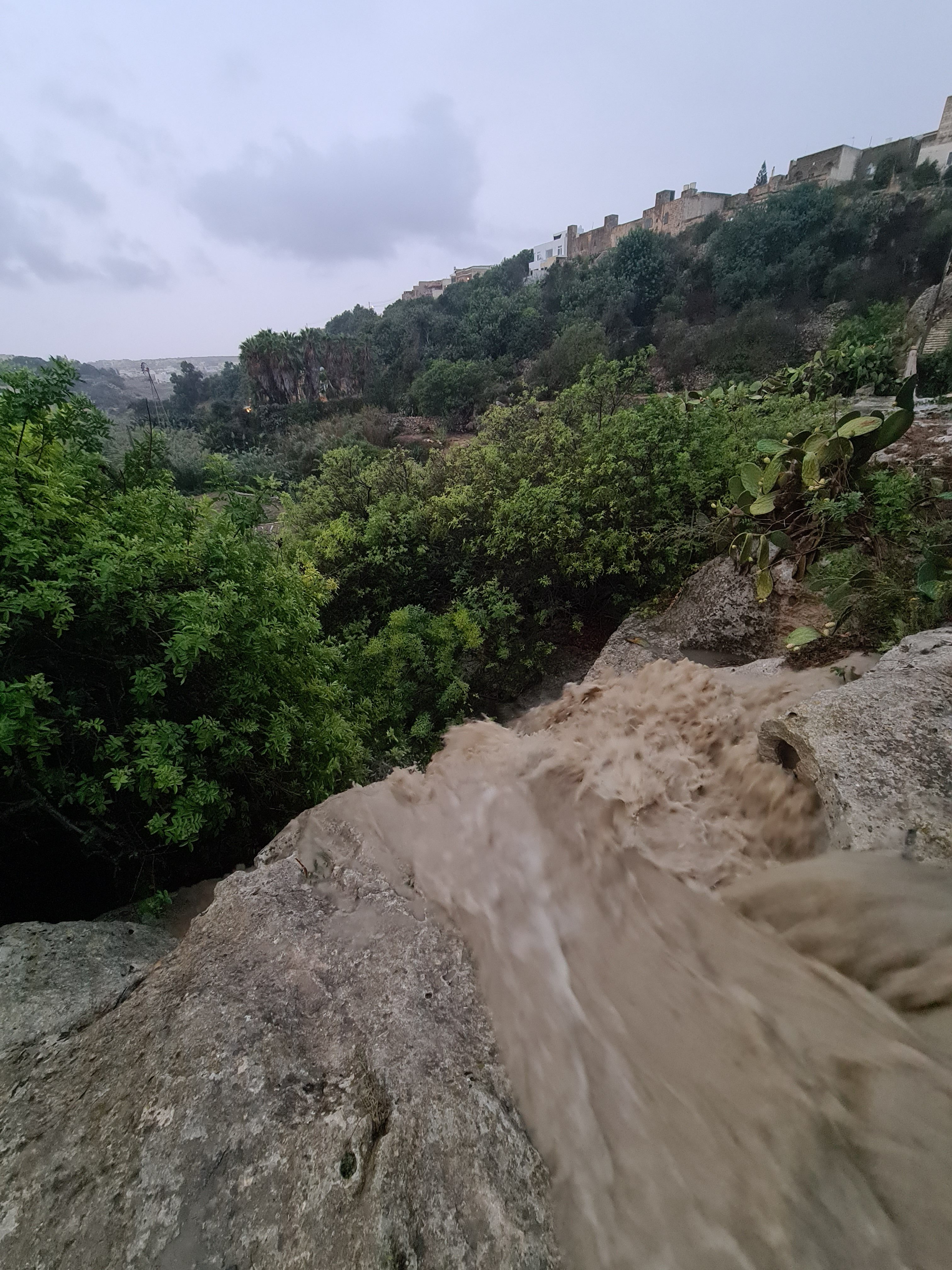
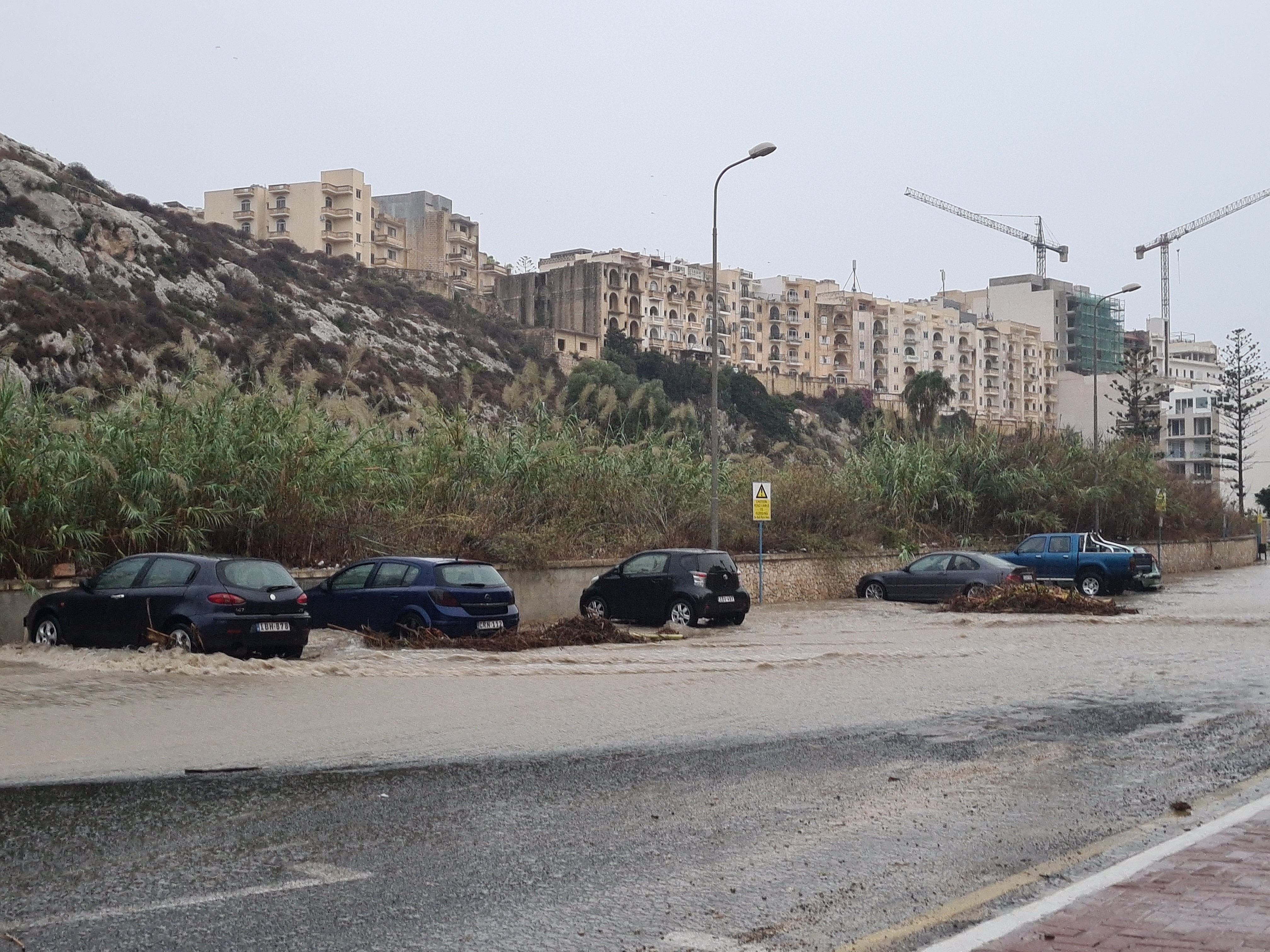
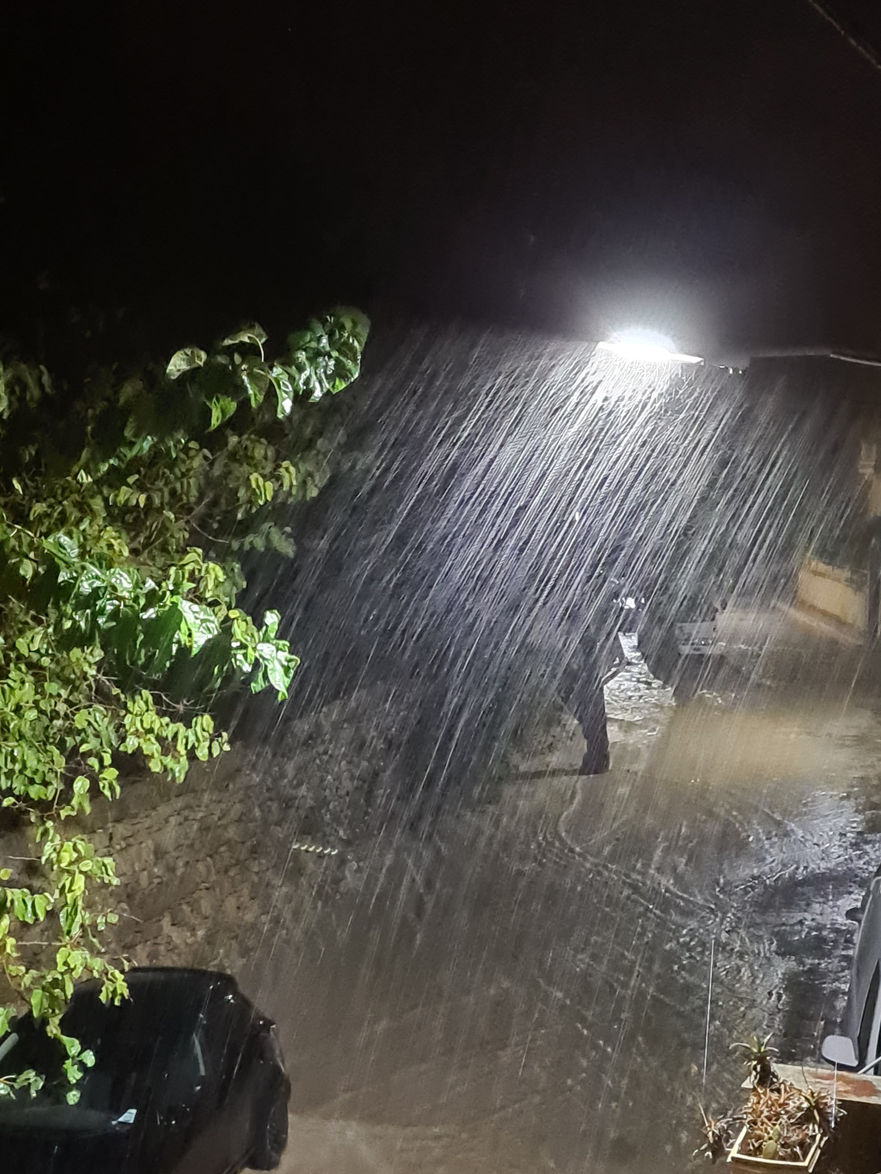
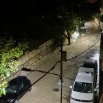
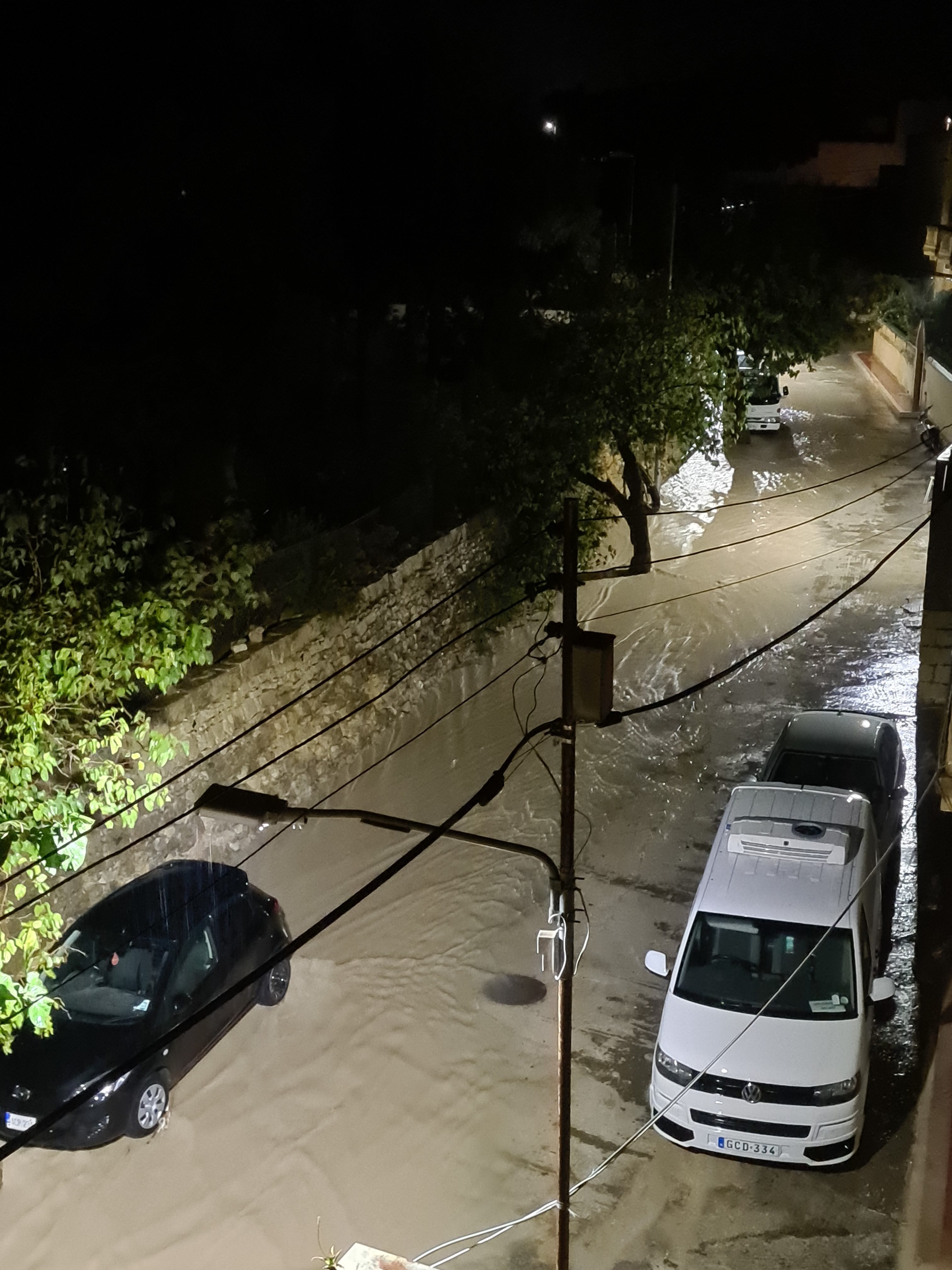
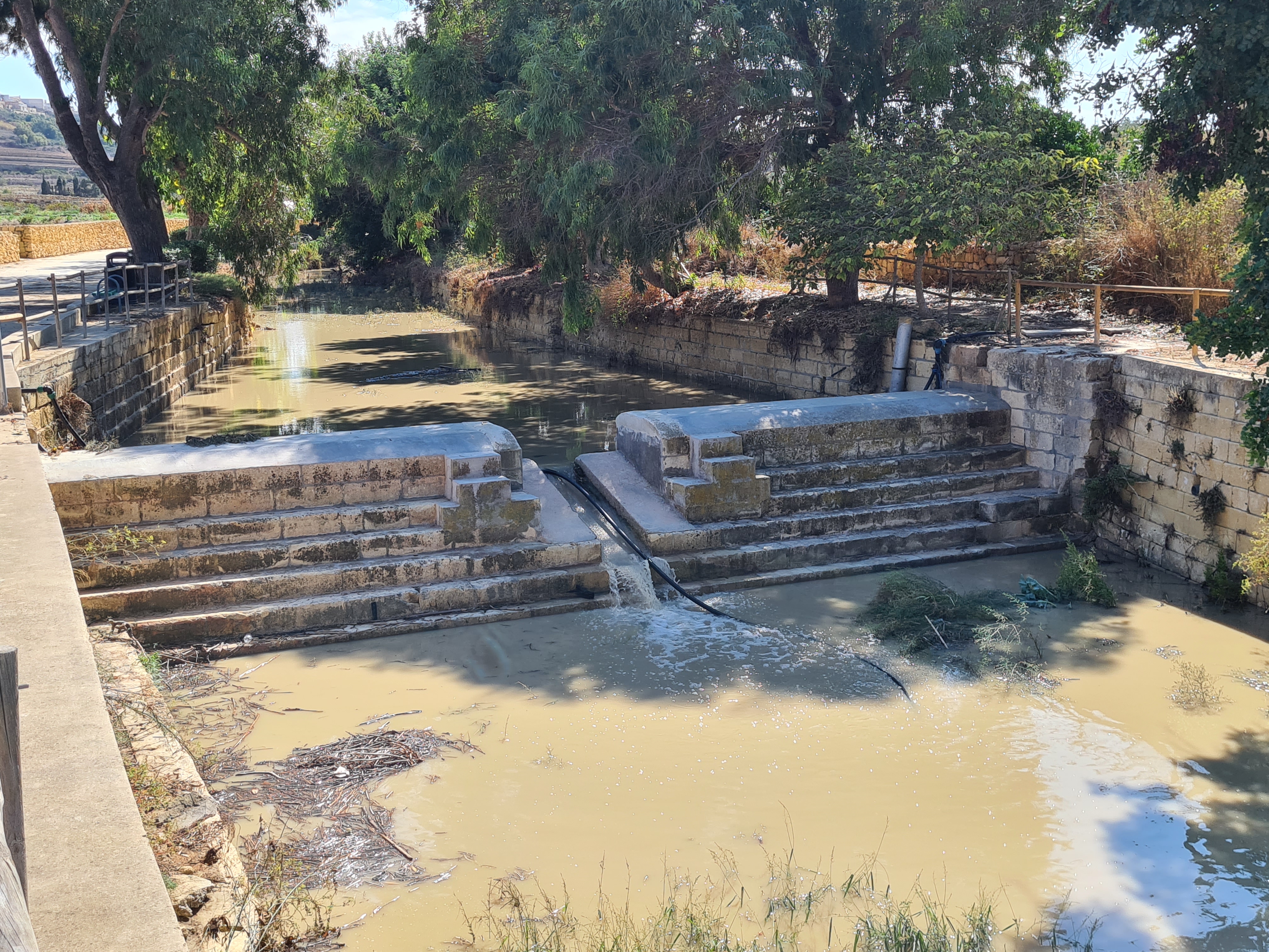
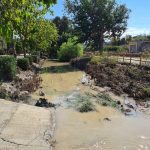
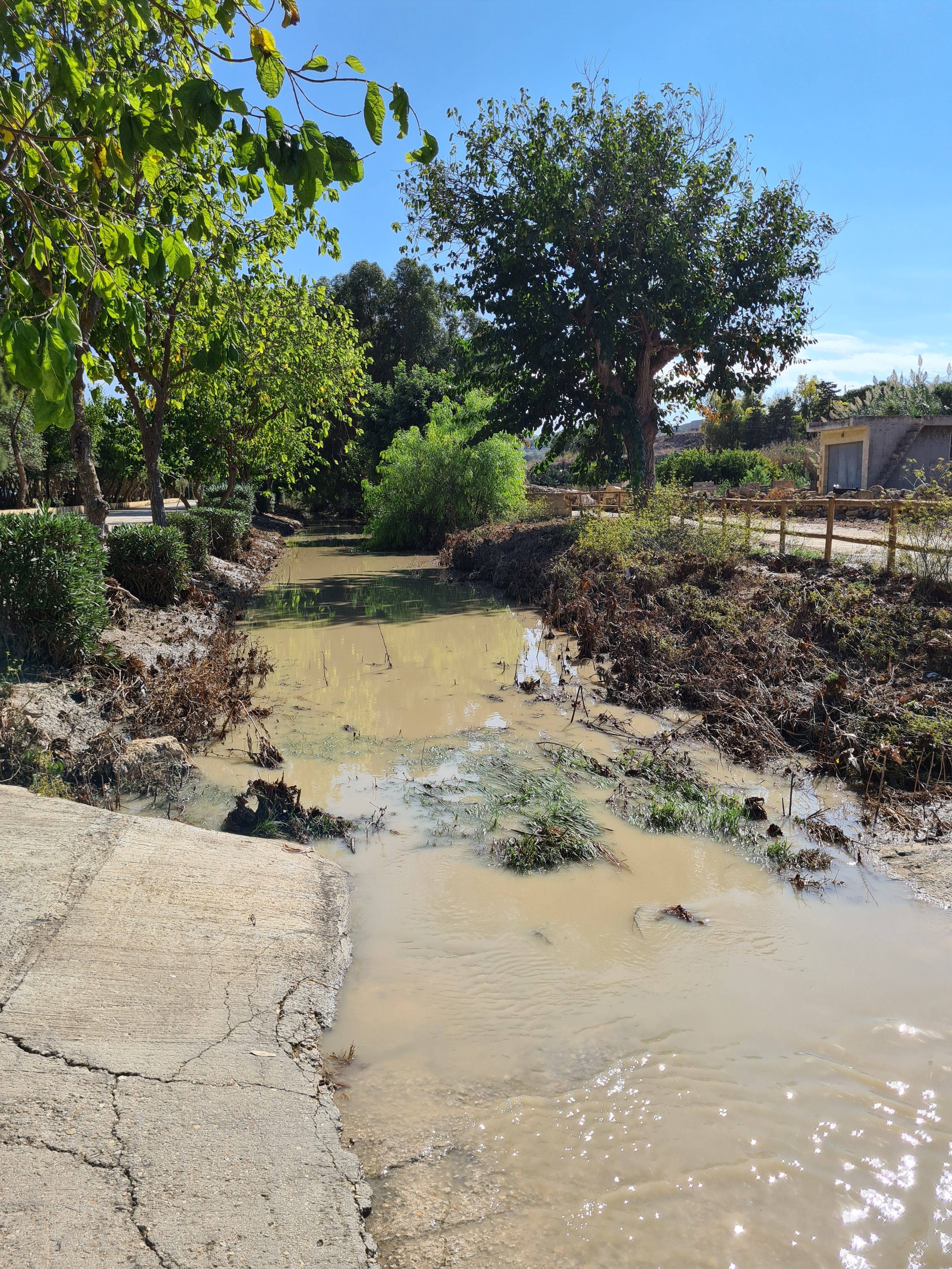
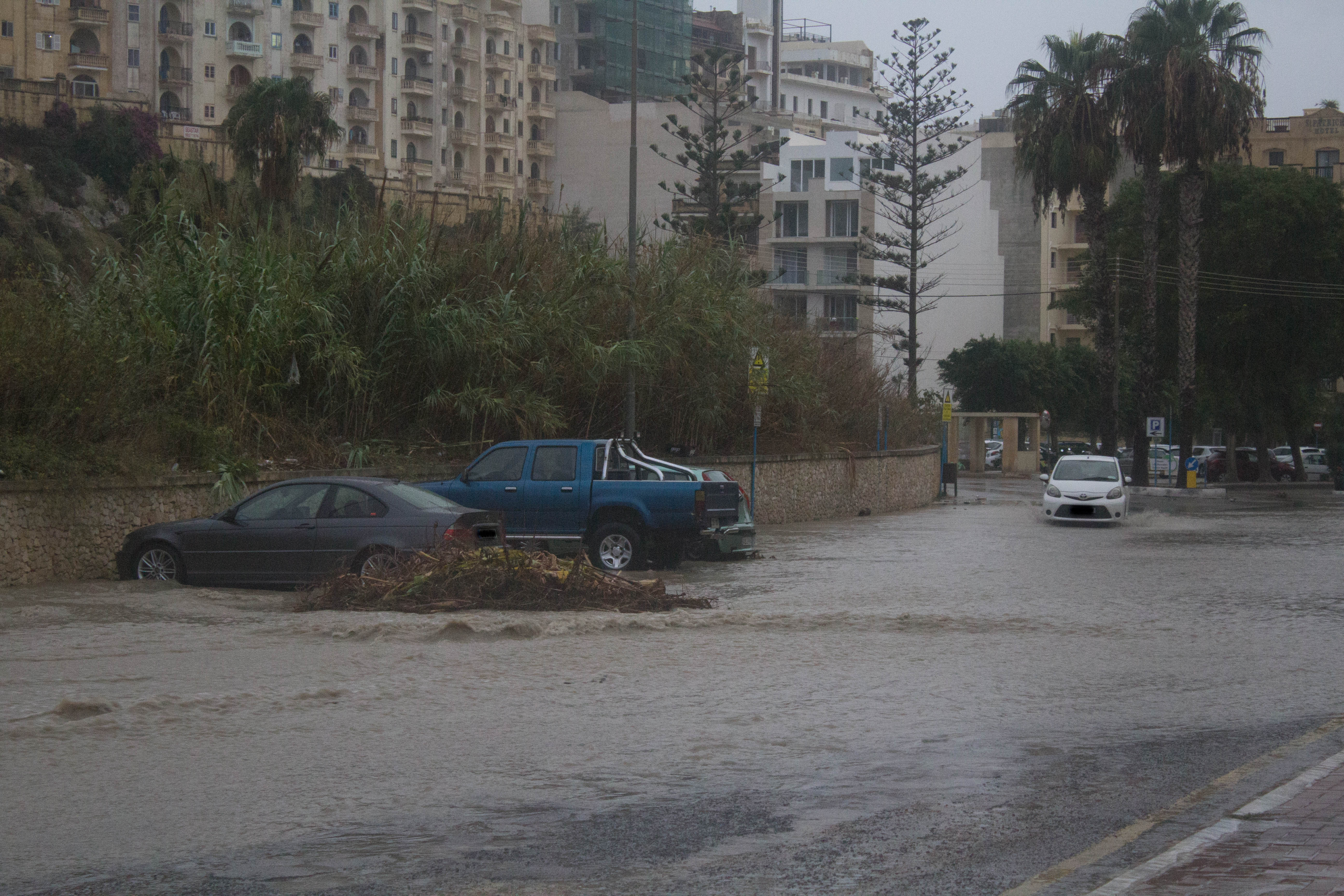
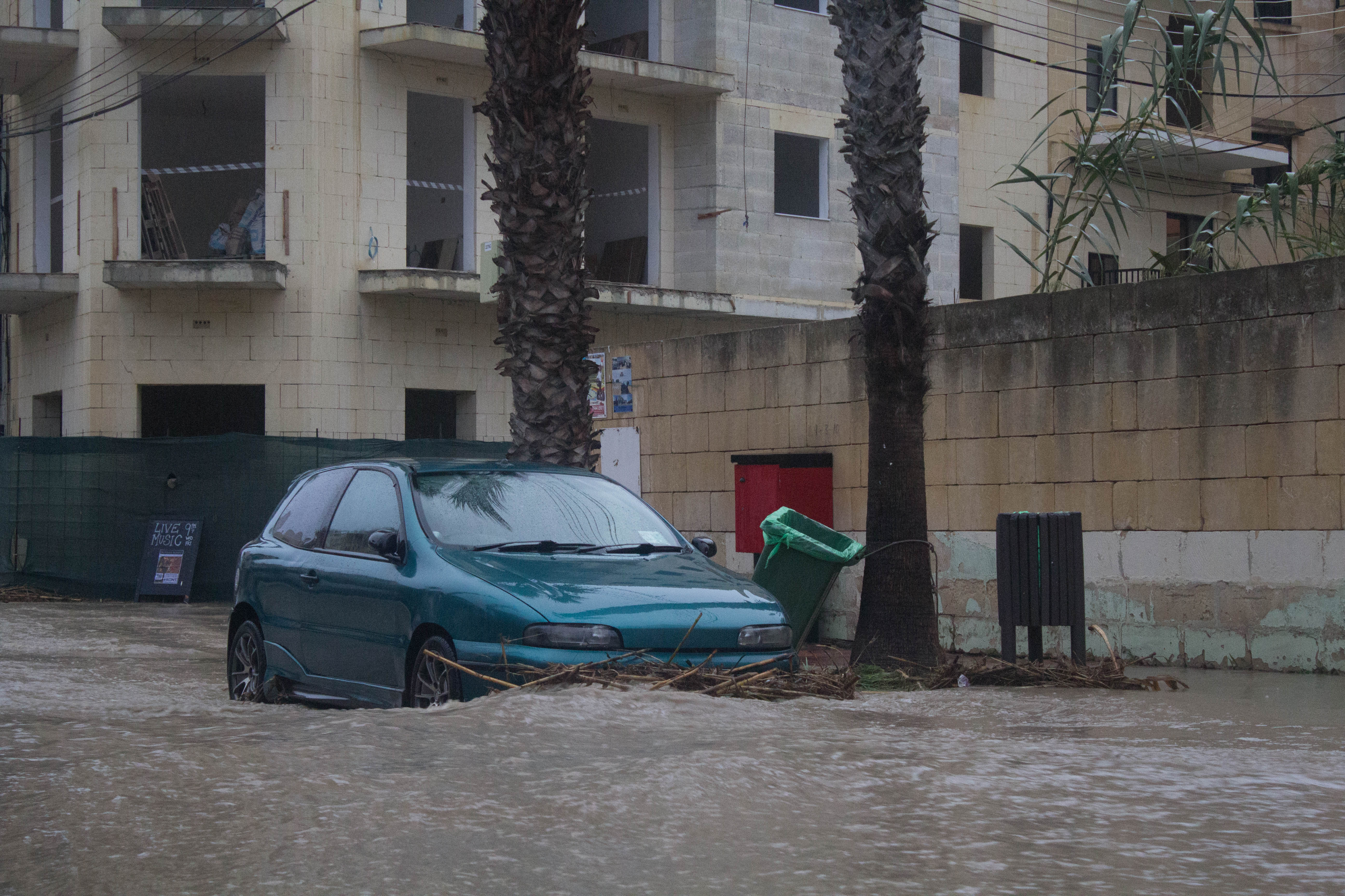
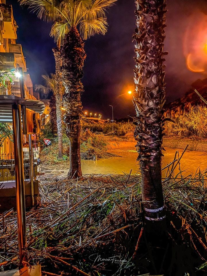
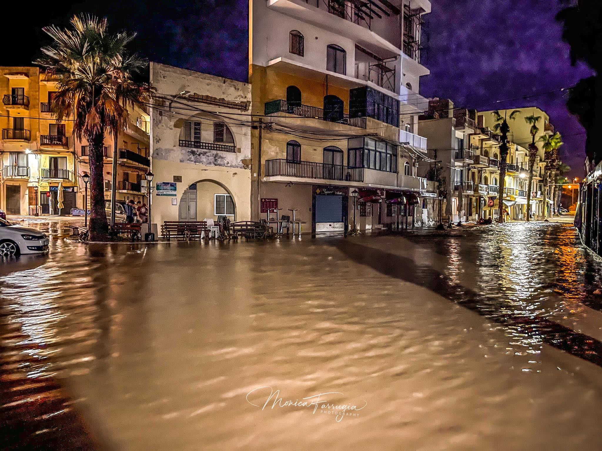
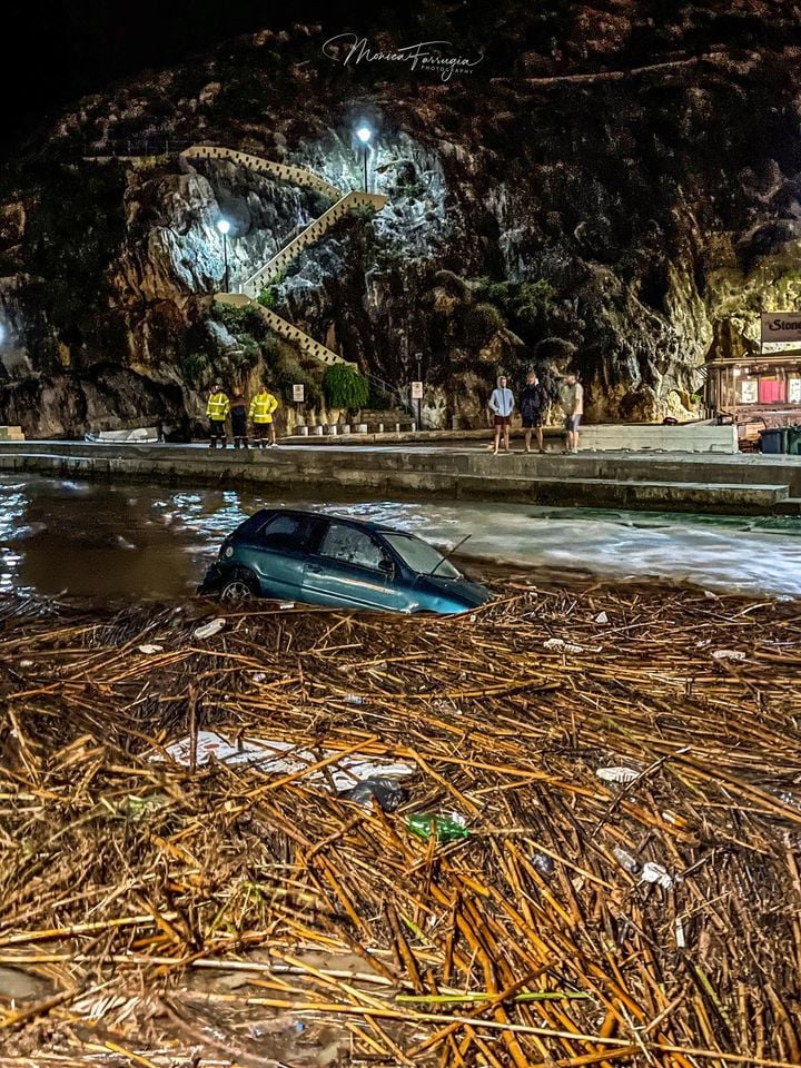
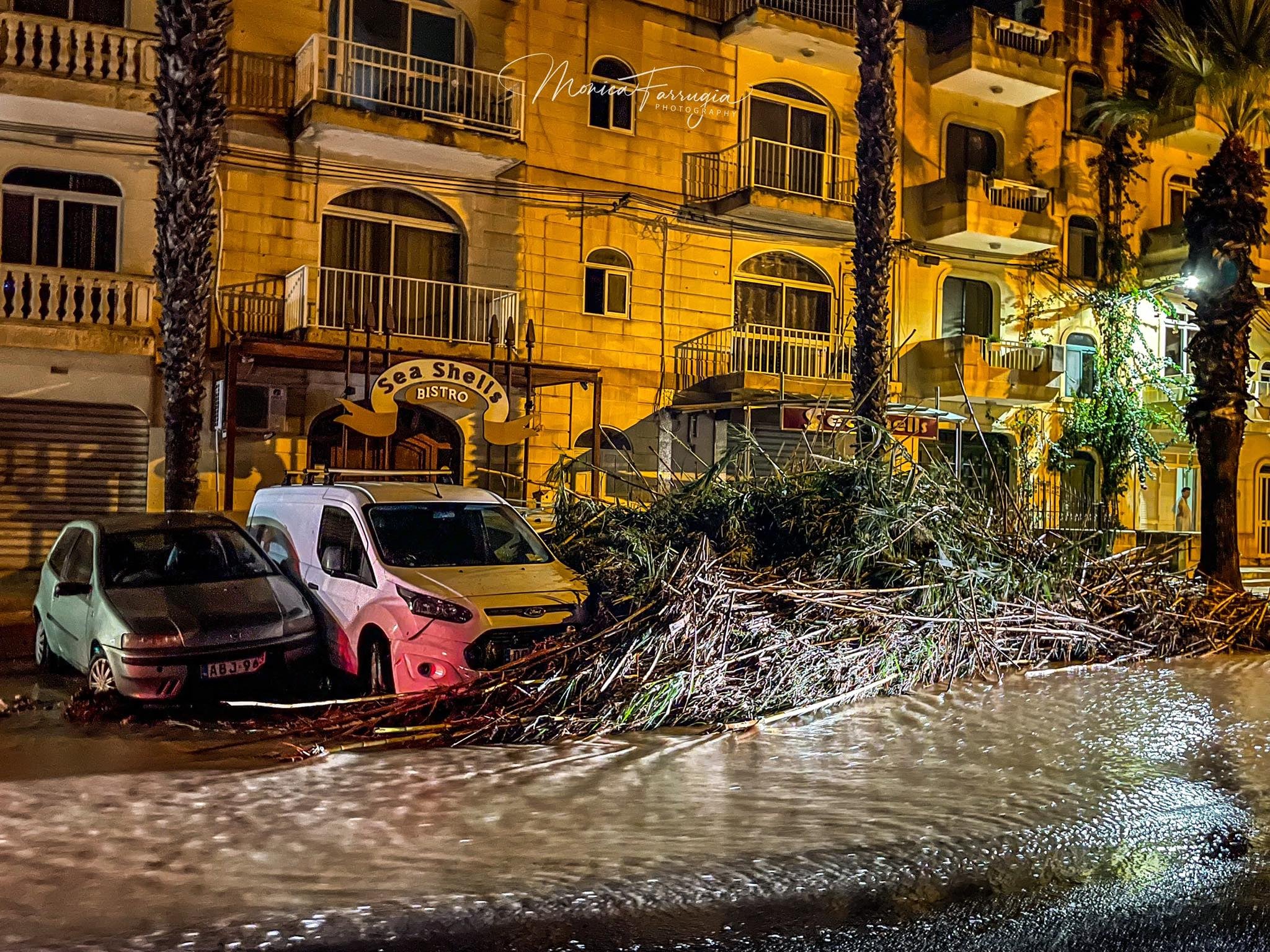
Most thunderstorms were localized, affecting a few localities at a time. At least two main thunderstorms affected the Maltese Islands. The first came in the early hours of Saturday 2/10, whilst the second hit some 24 hours later, in the early hours of Sunday 3/10. Gozo got the most rainfall from both thunderstorms. The second thunderstorm was the more intense one. It packed rainfall rates of over 300 mm / hr, winds of up to Force 7 and dangerous cloud-to-ground lightning. The coastal town of Xlendi, notable for frequent flooding in storms, bore the brunt of it all. The valley system that empties in Xlendi collects run-off from the localities which received the most rainfall from these thunderstorms. Cars were carried to sea and debris littered the roads. Rainfall during the second thunderstorm was most intense between 3:28 a.m. and 3:39 a.m. when a staggering 37.8 mm of rain were dumped in just 11 minutes. The temperature dropped from 23.6°C to 17.9°C during the thunderstorm. The wind gusted up to 56.3 km/h. In addition to these two main storms, a few other showers and isolated thunderstorms also affected the islands over a period of some 48 hours. The absence of wind at the upper levels of the atmosphere meant that the entire zone of instability, along with all the individual thunderstorms within it were extremely slow-moving. This exacerbated further the amount of rainfall dumped by the storms. Below are values for total rainfall gathered in several localities around the Maltese Islands:
Għarb – 32.1 mm + 69.5 mm = 101.6 mm
Victoria – 26.3 mm + 59.7 mm = 66.0 mm
Xewkija – 21.8 mm + 37.4 mm = 59.2 mm
Nadur – 26.9 mm + 60.9 mm = 87.8 mm
Marsalforn – 38.1 mm + 55.5 mm = 93.6 mm
Mellieħa = 8.8 mm + 32.4 mm = 41.2 mm
Buġibba – 15.0 mm + 25.2 mm = 40.2 mm
Mġarr – 13.7 mm + 31.0 mm = 44.7 mm
Naxxar – 12.2 mm + 26.4 mm = 38.6 mm
Mosta – 9.8 mm + 14.7 mm = 24.5 mm
Dingli – 24.3 mm + 28.6 mm = 52.9 mm
Msida – 22.4 mm + 21.1 mm = 43.5 mm
Valletta – 19.8 mm + 23.6 mm = 43.4 mm
Sliema – 23.4 mm + 18.3 mm = 41.7 mm
Mqabba – 22.6 mm + 24.9 mm = 47.5 mm
Żabbar – 17.5 mm + 16.3 mm = 33.8 mm
Birżebbuġa – 12.2 mm + 12.0 mm = 24.2 mm
Thanks to these thunderstorms, the total rainfall all round the Maltese Islands for October 2020 is already more than half than the climate average for the same month.
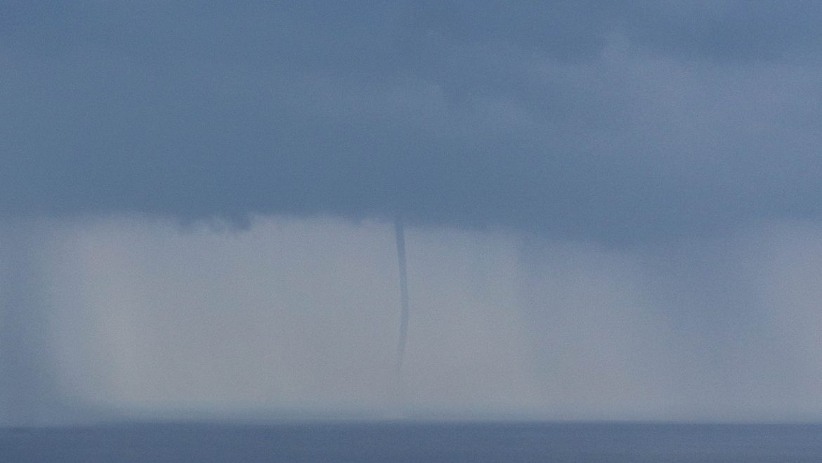
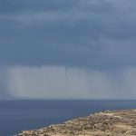
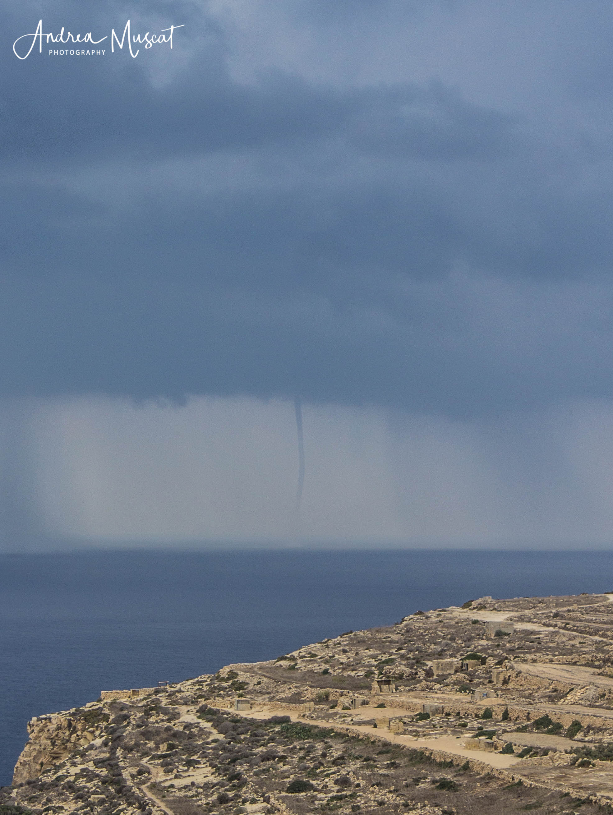
A series of waterspouts were observed, particularly on Friday. These start their existence as a funnel cloud below a cumuliform cloud when a column of swirling air begins to rotate, causing the surrounding moisture to condense into water droplets. This vortex begins to move downward, creating a funnel shape which protrudes for a distance below the cloud. Often, it is too weak to extend all the way down and make contact with the ground. When it does manage contact with the ground, it takes the form of a weak waterspout or landspout. Most funnels which form locally are of this kind, and rarely of their stronger relatives, the tornadoes.
-

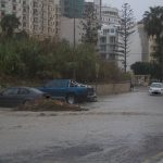
- Andrea Muscat
-

- Andrea Muscat
-

- Andrea Muscat
-

- Andrea Muscat
-

- Andrea Muscat
-
- Andrea Muscat
-
- Andrea Muscat
-

- Andrea Muscat
-

- Andrea Muscat
-

- Andrea Muscat
-
- Andrea Muscat
-
- Andrea Muscat
-
- Andrea Muscat
-

- Andrea Muscat
-

- Andrea Muscat
-
- Andrea Muscat
-
- Andrea Muscat
-
- Andrea Muscat
-
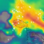
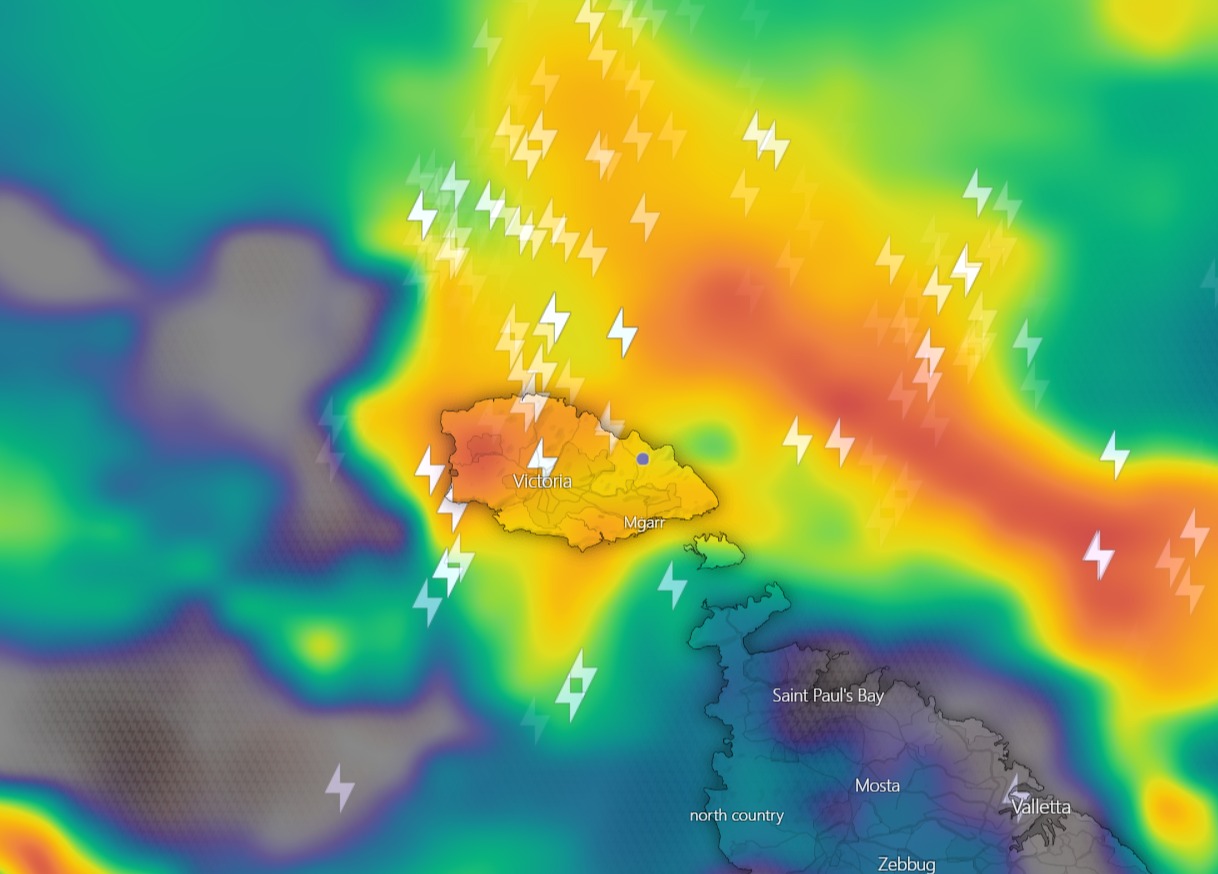
- A radar image of the second and most intense thunderstorm shows rainfall intensity over Gozo.
-
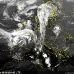
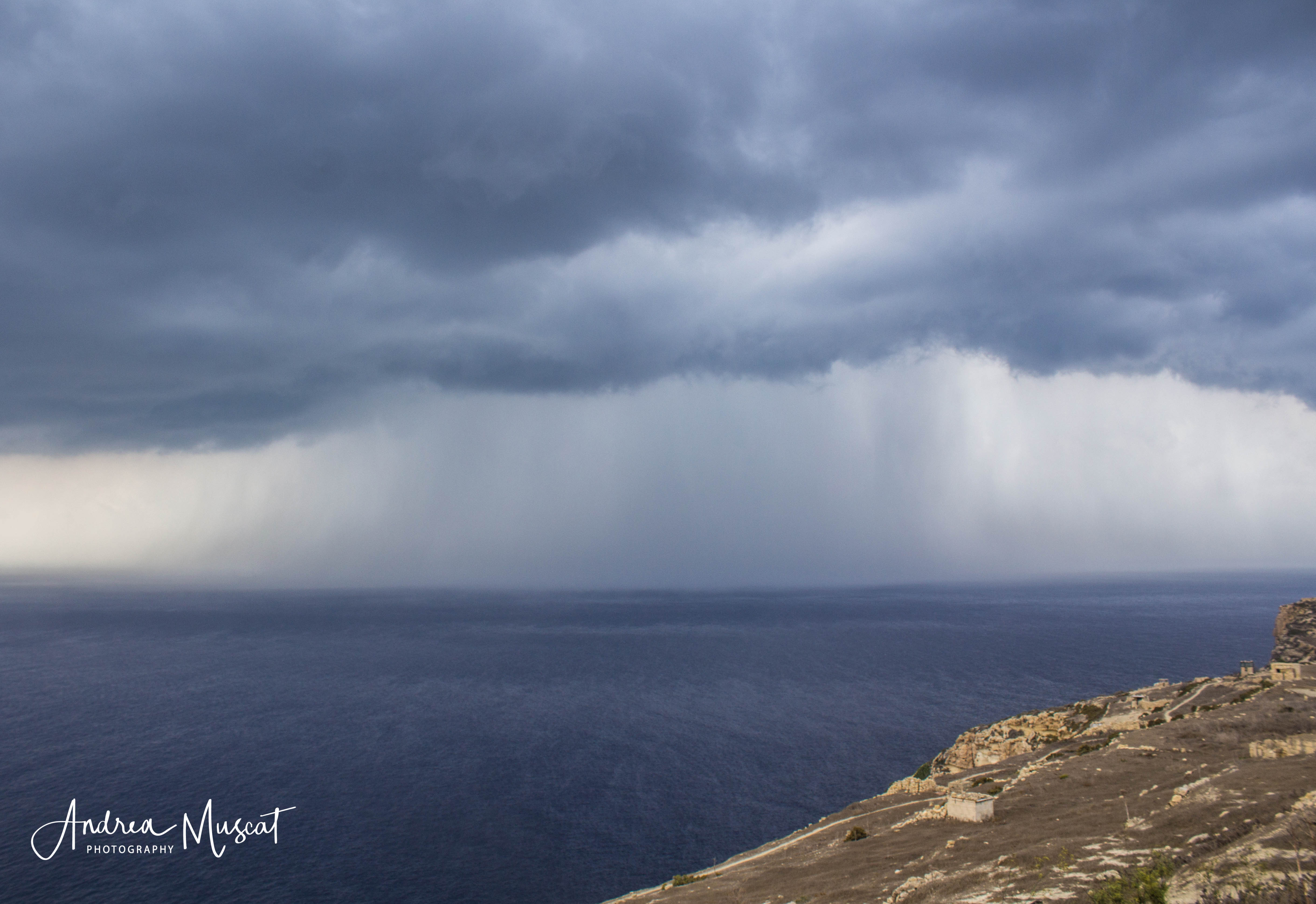
- The first thunderstorm came in the early hours of Saturday 2/10.
-
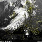
- The second and most intense thunderstorm came in the early hours of Sunday 3/10.
-
- Andrea Muscat
-

- Andrea Muscat
-

- Monica Farrugia
-

- Monica Farrugia
-

- Monica Farrugia
-

- Monica Farrugia
0 comments
Write a comment