Updates

For the latest updates related to the weather in the Maltese Islands. So keep yourself updated by visiting this page frequently or like our Facebook page.

Updates

This week: Rainy days ahead

After a completely dry first half of the month, the third week of November will see a complete change in the meteorological situation across the central Mediterranean. The high pressure that brought persistent fine weather is retreating https://polska-ed.com/kupic-generic-cialis/. This will allow low pressure systems from over the Atlantic to penetrate our region. In fact, the Maltese Islands should be affected by two successive storm systems over the course of this week. With regards to rainfall, this week looks really promising. Whilst rain is possible on any day in the coming week, it appears that Tuesday 17/11 and Saturday 21/11 could be the wettest days. Temperatures will experience a noticeable decline, with highs falling from 23°C at its start to below 20°C by the weekend. Lows will be in the region of 13°C to 15°C. Most days should be characterized by moderate winds. Wind direction will shift between Northwest and Northeast alternatingly over the course of this week. A very strong Northeast wind cannot be ruled out for the weekend. We will have to wait a few more days to see if this will materialize or not, however. What we are sure of is the fact that this week will bring the decisive change in weather many have been waiting for.

Updates

This week: Remaining without any significant rainfall

The weather this week is likely to be more or less a continuation of last week’s. We’re expecting most days this week to be characterised by partly to variably cloudy skies. A few brief and localised isolated showers may occur on a few days this week. Most places will remain dry, however. The chance of any significant rainfall will remain close to negligible. Temperatures will be cooler than last week. All days this week will be characterised by 21°C / 22°C highs and 14°C / 15°C lows. Once again, strong winds will be absent throughout this week. The wind will be mainly light from regularly shifting directions. 

Updates

Drier than average weather to continue / Se nkomplu b’anqas xita mill-medja

ENGLISH/INGLIŻ

A promising start to the rainy season in September quickly turned into disappointment in October. The drier than average trend has lingered into November too. As explained in our long-term weather outlooks, the pattern of mild weather will likely stay with us, at least for now. An area of high pressure covering vast swathes of the Balkans and the central Mediterranean will persist. This blocking pattern, or anticyclone, blocks incoming low pressure systems. In our case, low pressure systems which normally approach us from the west are deviated further north. All but the most intense of these manage to reach us. When they do reach us, they’ll likely be decayed by the stable atmosphere above us, however. Locally, some rain clouds still manage to form from convection. These are rarely strong enough to produce anything more than a brief isolated shower. The latest weather maps are not indicating any widespread significant rainfall in the near future. The only rain we’ll be getting for now will be in the form of brief and localised showers that affect small spots at a time. Despite them being intense at times, their brief nature will not allow for a significant amount of rain. These spotty showers will be possible on a number of days. Most days will continue to be variably to mostly cloudy at times. Another noticeable feature that will prevail for now is the absence of very strong winds and the great variability in wind direction.


MALTI / MALTESE

Il-bidu promettenti għal dan l-istaġun ta’ xita f’Settembru ma damx ma qaleb f’diżappunt f’Ottubru. It-tendenza ta’ nuqqas ta’ xita baqgħet sejra f’Novembru. Kif spjegat fit-tbassir fit-tul tagħna, din it-tendenza ta’ nixfa mistennija tibqa magħna għalissa. Firxa ta’ arja bi pressjoni għolja li qed tgħatti partijiet mill-Balkani u l-Mediterran għandha tippersisti. Dan l-antiċiklun se jkun qed jipprevjeni sistemi ta’ maltemp minn fuq l-Atlantiku minn li jilħquna. Xi wħud li jkunu partikolarment intensi biss kapaċi jilħquna. Jekk dawn jilħquna, probabli jkunu ddgħajfu sew taħt l-effett ta’ l-atmosfera stabbli madwarna, pero’. Lokalment, xi sħab tax-xita xorta se jibqa jifforma. Dawn rari jkunu qawwija biżejjed biex jagħtu aktar minn ħalba xita iżolata qasira. L-aħħar mudelli tat-temp jibqgħu juru nuqqas ta’ xita sinifikanti u mifruxa. L-uniku xita li se jkollna għalissa ser tkun fil-forma ta’ ħalbiet tax-xita lokaliżżati u qosra. Għalkemm xi wħud jaf ikunu xi ftit intensi, il-fatt li jispiċċaw fi ftit ħin, ma jidhirx li jistgħu jagħtu xi ammonti kbar ta’ xita. Xita ta’ din it-tip se tkun possibbli f’numru ta’ jiem. Il-jiem li ġejjin se jibqgħu jkunu ftit jew wisq imsaħħba. Ħaġa oħra notevoli li se tibqa magħna għalissa hija l-assenza ta’ riħ qawwi ħafna u l-varjazzjoni kbir fid-direzzjoni tar-riħ minn jum għal ieħor.

Updates

This week: A lack of rain, light winds and warm temperatures

The first week of November will maintain the trend set in the previous month. Much of next week will be seeing continued fine weather. There is a good chance that this week will be completely dry. Temperatures will be stable. All days are likely to be characterised by 22°C to 24°C highs and 16°C / 17°C lows. Winds will be noticeably light for much of the time too, with no days expected to register wind speeds stronger than Force 5. The Westerly wind will give way to a more Easterly wind by midweek. A surreal calm is anticipated across the Maltese Islands from Wednesday 04/11 through to Friday 06/11.

Updates

October’s final showers / L-aħħar xita għal Ottubru

ENGLISH/INGLIŻ

A cold front that will traverse the central Mediterranean on Tuesday 27/10 will bring what is likely to be the final episode of bad weather for this month. The warm sea locally will clash with the incoming cold air to create a zone of instability. This zone of instability will be centred over the Ionian Sea. Its edges will cover the Maltese Islands. A series of showers possibly heavy and thundery at times are likely from time to time on Tuesday 27/10. The national average is expected to be within 5 mm to 20 mm. Residual showers will then prevail into Wednesday 28/10. Another effect of this cold front will be a strong Mistral. The wind will turn Northwest by morning on Tuesday and increase gradually as the day progresses. It will be strongest from late evening on Tuesday till late morning on Wednesday. Maximum speeds should reach Force 7. The wind should decline on Thursday 29/10. Both Tuesday and Wednesday will be noticeably cooler.


MALTI / MALTESE

Front kiesaħ li se jgħaddi minn fuq iċ-ċentru tal-Mediterran nhar it-Tlieta 27/10 se jkun qed iġib miegħu l-aħħar episodju ta’ maltemp għal dan ix-xahar. Massa ta’ arja kiesħa se tkun imbuttata fuq il-baħar sħun ta’ madwarna biex b’hekk tinħoloq żona ta’ instabilita. Din iż-żona ta’ instabilita se tkun iċċentrata fuq il-Baħar Jonju. It-truf tagħha mistenni jgħatti l-Gżejjer Maltin. Numru ta’ ħalbiet tax-xita possibilment qawwija u bir-ragħad kultant mistennija minn ħin għal ieħor nhar it-Tlieta 27/10. Il-medja nazzjonali mistennija tkun ta’ bejn 5 mm u 20 mm. Ħalbiet tax-xita residwi se jkomplu matul il-jum ta’ l-Erbgħa 28/10. Effett ieħor ta’ dan il-front kiesaħ se jkun riħ qawwi mill-Majjistral. Ir-riħ se jdur Majjistral mit-Tlieta filgħodu u jżid bilmod matul il-jum. Dan se jkun l-aktar qawwi minn tard filgħaxija tat-Tlieta sa tard filgħodu l-Erbgħa. Ir-riħ se jilħaq Forza 7. Dan se jonqos għal Ħamis 29/10. Kemm it-Tlieta kif ukoll l-Erbgħa se jkunu ferm aktar friski.

Updates

This week: Getting cooler

Much of next week, with the exception of Tuesday 27/10 (and possibly Wednesday 28/10), will be characterised by mainly fine weather. Some showers are likely on Tuesday. Rain should not be particularly abundant, however, thus confirming October as a drier than average month! Temperatures will be noticeably cooler this week too https://polska-ed.com/kupic-generic-cialis/. Daytime highs of 20°C / 21°C and night time lows of 15°C / 16°C will characterise all but one days this week. With a 23°C high and 17°C, the first day of the week will be the warmest. The trend of strong winds will likely continue, but a decline in strength will be noticed as the week progresses. It will be predominantly Northwest before starting to vary by the weekend.

Updates

Wind to strengthen for the weekend / Ir-riħ se jitqawwa għal tmiem il-ġimgħa

ENGLISH/INGLIŻ

A wave of instability is likely across the Maltese Islands over the weekend and the first half of next week. Colder air from the north will infiltrate our region, generating low pressure over the central Mediterranean. The first impact will be a strong wind from the Northwest on Saturday 24/10 and Sunday 25/10. The wind, which will veer from the Northwest by morning on Saturday, will increase gradually from early in the day. It will reach Force 5/6 from the early afternoon on Saturday through to early morning on Sunday, before decreasing gradually to become Force 4/5 during the day on Sunday. Whilst a weather warning is not deemed necessary, you’re still advised to avoid coastal areas known to be rough when the blows from the Northwest.

The unstable weather may intensify in the first half of next week with rain, colder temperatures and further strong winds being possible, particularly on Tuesday 27/10 and Wednesday 28/10. More on this as the days progress.


MALTI / MALTESE

Mewġa ta’ instabbilita mistennija fuq il-Gżejjer Maltin fi tmiem il-ġimgħa u l-ewwel nofs tal-ġimgħa li ġejja. Arja kiesħa mit-tramuntana se tippenetra r-reġjun tagħna u tiżviluppa pressjoni baxxa madwar iċ-ċentru tal-Mediterran. L-ewwel impatt ta’ dan se jkun riħ qawwi mill-Majjistral nhar is-Sibt 24/10 u l-Ħadd 25/10. Ir-riħ, li se jdur mill-Majjistral minn kmieni s-Sibt, se jżid gradwalment. Ser jilħaq Forza 5/6 minn kmieni wara nofsinhar tas-Sibt sa kmieni filgħodu tal-Ħadd, qabel ma jonqos għal Forza 4/5 matul il-jum tal-Ħadd. Għalkemm jidher li mhux se jkun hemm lok ta’ twissija, xorta navżawkhom biex tkunu prudenti f’inħawi magħrufha li jinħakmu minn Majjistral qawwi.

It-temp instabbli jaf jintensifika fl-ewwel nofs tal-ġimgħa li ġejja b’xita, temperaturi aktar friski u aktar riħ qawwi jkunu possibli, speċjalment nhar it-Tlieta 27/10 u l-Erbgħa 28/10. Aktar dwar dan matul il-jiem li ġejjin.

Updates

Summer time ends / Jispiċċa l-ħin tas-sajf

ENGLISH/INGLIŻ

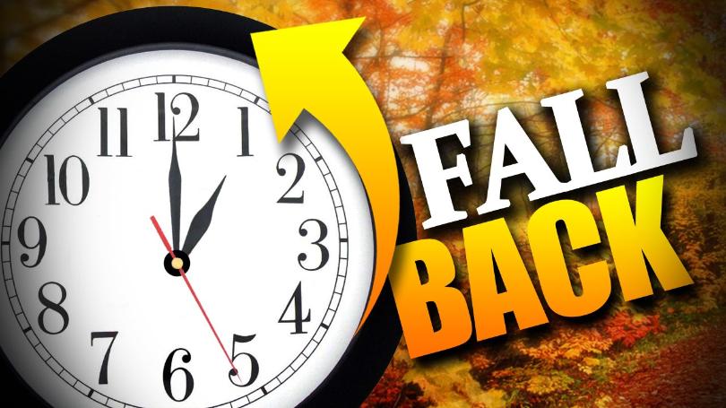
We set clocks back an hour this weekend. The German Empire and its World War I ally Austria-Hungary were the first to use Daylight Saving Time (DST) as a means of conserving coal during wartime. Others followed suit. Most countries abandoned it in the years following World War II. Since then, the world has seen many enactments, adjustments, and repeals. Much of Africa, Asia, South America and Oceania do not follow it anymore. Back in 2019 the European Parliament approved a proposal to scrap the system across the European Union. To ensure planning for a smooth transition this has been postponed until at least 2021. Under the draft directive, member states would be able to choose whether to remain on their current summer time, in which case the last transition would be on the last Sunday of March 2021, or their current winter time, which would then take permanent effect from the last Sunday of October 2021. There are several arguments, both in favor and against. Do you think Daylight Saving Time is still relevant nowadays?

This year, Daylight Saving Time ends in the night between Saturday 24/10 and Sunday 25/10, so do not forget to move your clock back one hour before going to bed on Saturday. On Sunday, the sun rises at 06:17 and sets at 17:13, as winter slowly sets in.


MALTI / MALTESE

Fi tmiem il-ġimgħa l-arloġġi inmexxuhom siegħa lura. L-Imperu Germaniż, flimkien ma’ l-alleati tiegħu ta’ l-Ewwel Gwerra l-Awstrija u l-Ungerija, kienu l-ewwel li ħarġu bl-idea tal-bidla fil-ħin. Dan biex inaqqsu l-konsum tal-faħam fi żmien il-gwerra. Oħrajn għamlu bħalhom. Ħafna pajjiżi ma baqgħux jużaw din is-sistema’ wara t-Tieni Gwerra. Minn dakinhar sa issa, id-dinja rat ħafna tibdil f’din is-sistema’. Ħafna minn l-Afrika, l-Asja, l-Amerka ta’ Isfel u l-Awstralja ma għadhomx b’din is-sistema’ ta’ ħin. Fl-2019, il-Parlament Ewropwe approva proposta li s-sistema ta’ bdil fil-ħin tieqaf madwar l-Unjoni Ewropea kollha. Biex kollox ikun pjanat u t-tranżiżżjoni tkun waħda bla xkiel, ġie miftiehem li l-bidla ssir fl-2021. Stati membri riedu jiddeċiedu jekk hux se jżommu l-ħin tax-xitwa jew dak tas-sajf. Jekk iżommu l-ħin tas-sajf l-aħħar bidla sseħħ f’Marzu 2021. Min iżomm il-ħin tax-xita l-aħħar bidla tkun f’Ottubru 2021. Hemm diversi argumenti favur u kontra. Int taħseb li l-bidla fil-ħin għadha relevanti llum il-ġurnata?

Il-ħin tas-sajf jasal fi tmiemu matul il-lejl ta’ bejn is-Sibt 24/10 u l-Ħadd 25/10. Għalhekk tinsewx tressqu l-ħin b’siegħa lura qabel torqdu. Nhar il-Ħadd, ix-xemx titla fis-06:19 u tinżel fil-17:12, hekk kif ix-xitwa tkompli toqrob.

Updates

This week: Remaining largely dry

Weekdays will see the continuation of cool temperatures. Daytime highs of around 22°C and night time lows in the region of 15°C / 16°C will continue till Thursday 22/10. We are likely to experience warmer temperatures over the weekend. We’re looking at 24°C / 25°C highs and 17°C / 18°C for then. Winds will be lighter too over the course of this week. The Northwest wind will give way to more southerly winds from Monday 19/10, before turning again by Sunday 25/10 polska-ed.com. The dry spell that has characterised our weather for just over a month will continue. The little light rain we’ll see on Monday 19/10 will be the only rain this week. The rest of the week will be mainly sunny or partly cloudy.

Updates

This week: Windy conditions to dominate

Temperatures turned more seasonal last week. This cooling trend will be maintained this week. With a daytime high below 20°C, Monday 12/10 will be unseasonably cool. Temperatures will recover from Tuesday 13/10, with 21°C to 23°C highs and 16°C to 18°C lows on all but one day. With a maximum in the region of 25°C, Thursday 15/10 will be this week’s warmest day. This week will be dominated by strong winds. In fact, the wind is likely to reach Force 5/6 at some point on all days till at least Saturday 17/10. Wind direction is expected to alternate between Northwest and Southwest. With a series of rain showers, Monday 12/10 and Tuesday 13/10 are set to be this week’s wettest days. A chance of rain also exists for Thursday 15/10. The remaining days will be mainly partly cloudy, although an isolated shower cannot be ruled out.