A rain shadow is a dry area on the leeward side of a stretch of land (normally a highland or mountainous area). This stretch of land dries up the air within a rain-producing weather system, casting an area of dryness on the leeward side. Wind and moist air is drawn by prevailing winds across this stretch of land. It condenses and precipitates as it does so. The air, without much moisture left (and no body of water to recharge itself), advances on creating an area of dryness called the rain shadow.
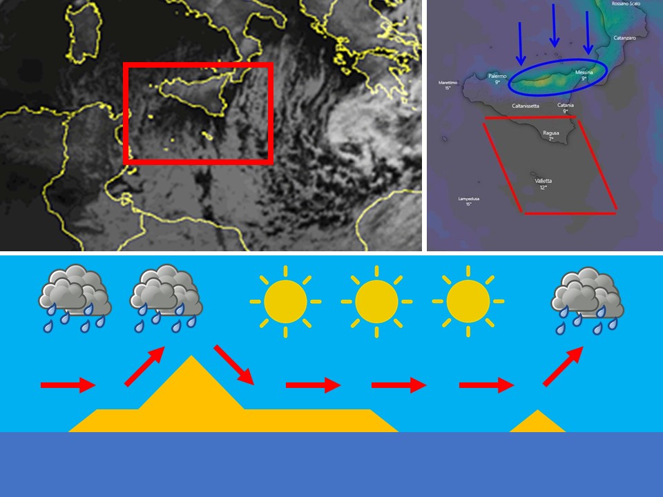
A kind of rain shadow forms over the Maltese Islands when the wind across the central Mediterranean blows from a northerly direction. Cold northerly air (blue arrows) moving towards the Maltese Islands encounters Sicily (including Mount Etna which stands at 3,326 meters above sea-level) on its way. The air is forced to rise and condense. Condensation produces rain-bearing clouds over Sicily’s northern coast (area encircled in blue). Precipitation occurs and the moisture carried by the cold northerly air is lost. As the cold northerly air advances further south, the stretch of sea between Sicily and the Maltese Islands is not wide enough for the air to recharge with moisture. As a result, the air is too dry to form any rain-bearing clouds locally. As a result, very little rain occurs over the Maltese Islands. That is why a North wind rarely brings any rain to our shores. This rain shadow is the the grey area indicated within the red lines. The satellite image on the left indicates today’s rain shadow formation. The bottom diagram is a diagram to help you understand the process more.
0 comments
Write a comment