Updates

For the latest updates related to the weather in the Maltese Islands. So keep yourself updated by visiting this page frequently or like our Facebook page.

Updates

STRONG WIND WARNING / TWISSIJA TA’ RIĦ QAWWI

An intense low pressure system will be moving across the Sicilian Channel on Saturday 16/11. Meanwhile, higher pressure will cover the southeastern Mediterranean. This will cause a strong, warm South Southeast wind to affect the area around the Maltese Islands. The wind will not be extremely strong, but taking the necessary precautions is helpful. This warning is valid from 09:00 on Saturday 16/11 till 06:00 on Sunday 17/11. The details below describe how the situation will be developing over this time period.


Saturday 16/11

09:00 to 12:00 – South Southeast Force 5/6 to 6/7

12:00 to 15:00 – South Southeast Force 6/7

15:00 to 18:00 – South Southeast Force 6/7

18:00 to 21:00 – South Southeast Force 6/7 at times 8

21:00 to 00:00 – South Southeast Force 6/7 at times 8


Sunday 17/11

00:00 to 03:00 – South Southeast Force 6/7

03:00 to 06:00 – South Southeast Force 6/7 to 5/6


The peak gusts will blow across the Maltese Islands in the evening on Saturday 16/11, and could reach Force 8 on exposed areas. The wind will turn West and decrease to Force 4/5 during the day on Sunday 17/11.

The sea will be rough, with wave heights of up to 5 metres in peak gusts. The swell will be low to moderate from a Southeast direction. The map shows the length of coastline most exposed to this strong wind.


Sistema ta’ pressjoni baxxa intensa se taqsam il-Fliegu ta’ Sqallija nhar is-Sibt 16/11. Sadattant, pressjoni għola se tikkaratteriżża l-inħawi tax-xlokk tal-Mediterran. Dan se jwassal għal riħ qawwi u sħun minn Nofsinhar ix-Xlokk madwar il-Gżejjer Maltin. Ir-riħ mhux se jkun qawwi ħafna, imma l-prekawzzjonijiet meħtieġa għandhom jittieħdu xorta waħda. Din it-twissija ta’ riħ qawwi se tkun fis-seħħ minn 09:00 tas-Sibt 16/11 sa 06:00 tal-Ħadd 17/11. Id-dettalji ta’ hawn taħt juru kif se tiżviluppa s-sitwazzjoni matul dan il-ħin.


Is-Sibt 16/11

09:00 sa 12:00 – Nofsinhar ix-Xlokk Forza 5/6 għal 6/7

12:00 sa 15:00 – Nofsinhar ix-Xlokk Forza 6/7

15:00 sa 18:00 – Nofsinhar ix-Xlokk Forza 6/7

18:00 sa 21:00 – Nofsinhar ix-Xlokk Forza 6/7 kultant 8

21:00 sa 00:00 – Nofsinhar ix-Xlokk Forza 6/7 kultant 8


Il-Ħadd 17/11

00:00 sa 03:00 – Nofsinhar ix-Xlokk Forza 6/7

03:00 sa 06:00 – Nofsinhar ix-Xlokk Forza 6/7 għal 5/6


Il-buffuri l-aktar qawwija mistennija filgħaxija tas-Sibt 16/11, u jistgħu jilħqu Forza 8 f’postijiet esposti. Ir-riħ idur Punent u jonqos għal-Forza 4/5 matul il-jum tal-Ħadd 17/11.

Il-baħar se jkun imqalleb, b’mewġ għoli 5 metri fl-aktar buffuri qawwija. L-imbatt se jkun baxxa għal moderat mix-Xlokk. Il-mappa tindika l-kosta l-aktar esposta għal dan ir-riħ.

Updates

A weekend with no rain / Tmiem il-ġimgħa bla xita

A weak area of high pressure will extend towards the central Mediterranean over the weekend, keeping an intense low pressure system over the western Mediterranean away from the Maltese Islands. No significant precipitation is expected over the weekend. The Southerly wind will be strong, however, particularly on Saturday. This may reach Force 6/7 at times. The Southerly wind will make for fairly warm temperatures on Friday and Saturday, with highs expected to reach 22 C on both days. The wind dies down and turns West on Sunday. This will bring temperatures down slightly, with highs set to dip to 18 C on the day.

Roqgħa ta’ pressjoni għolja dgħajfa se testendi għal fuq iċ-ċentru tal-Mediterran fi tmiem il-ġimgħa. Din għandha iżżomm sistema ta’ pressjoni baxxa intensa li bħalissa tinsab lejn il-punent tal-Mediterran ‘il bogħod minn xtutna. Mhux qed nistennew xita sinifikanti fi tmiem il-ġimgħa. Ir-riħ minn Nofsinhar se jkun qawwi, pero, speċjalment is-Sibt. Dan jaf jilħaq Forza 6/7 kultant. Ir-riħ isfel se jkun il-kaġun ta’ temperaturi sħan nhar il-Ġimgħa u s-Sibt, meta l-ogħla mistennija tilħaq 22 C. Ir-riħ ibatti u jaqleb Punent il-Ħadd. Dan iwassal għal temperaturi aktar friski ta’ 18 C.

Updates

What will the weather do next? X’se jagħmel it-temp issa?

The Mediterranean Tropical-Like Cyclone (or Medicane) which struck the Maltese Islands with heavy rain and gale-force winds has moved towards the Balkans, where it will soon dissipate The atmosphere above the central Mediterranean will remain unstable, however. An area of low pressure over the western Mediterranean will make its way towards our region. This will bring further isolated showers throughout the rest of Wednesday 13/11 and Thursday 14/11. A few of these may be heavy at times. The next rainfall, following that of today and tomorrow, is expected on Monday 18/11. The wind will be moderate from the West till late on Thursday 14/11. It will turn South on Friday 15/11, and become strong again on Saturday 16/11. It will reach Force 7/8 at times again on Saturday 16/11. It wil decrease again on Sunday 17/11, and remain moderate into next week.

Il-Medigan li affetwa lill-Gżejjer Maltin b’xita qawwija u riħ b’qawwa ta’ riefnu issa resaq lejn il-Balkani, fejn daqt jisfaxxa fix-xejn. Minkejja dan, l-atmosfera fuq iċ-ċentru tal-Mediterran se tibqa waħda nstabbli. Arja bi pressjoni baxxa fuq il-punent tal-Mediterran se torqob lejna. Din se ġġib magħha aktar ħalbiet iżolati tax-xita matul il-bqija ta’ l-Erbgħa 13/11 u l-Ħamis 14/11. Uħud minn dawn jistgħu jkunu qawwijin kultant. Ix-xita li jmiss, wara dik ta’ llum u għada, hija mistennija t-Tnejn 18/11. Ir-riħ se jkun moderat mill-Punent sa tard il-Ħamis 14/11. Dan idur Nofsinhar il-Ġimgħa 15/11, u jerġa jitqawwa s-Sibt 16/11. Għandu jilħaq Forza 7/8 mill-ġdid f’xi ħinijiet nhar is-Sibt 16/11. Ir-riħ jerġa jonqos il-Ħadd 17/11, u jibqa moderat sa kmieni l-ġimgħa d-dieħla.

Updates

DOUBLE WARNING / TWISSIJA DOPPJA

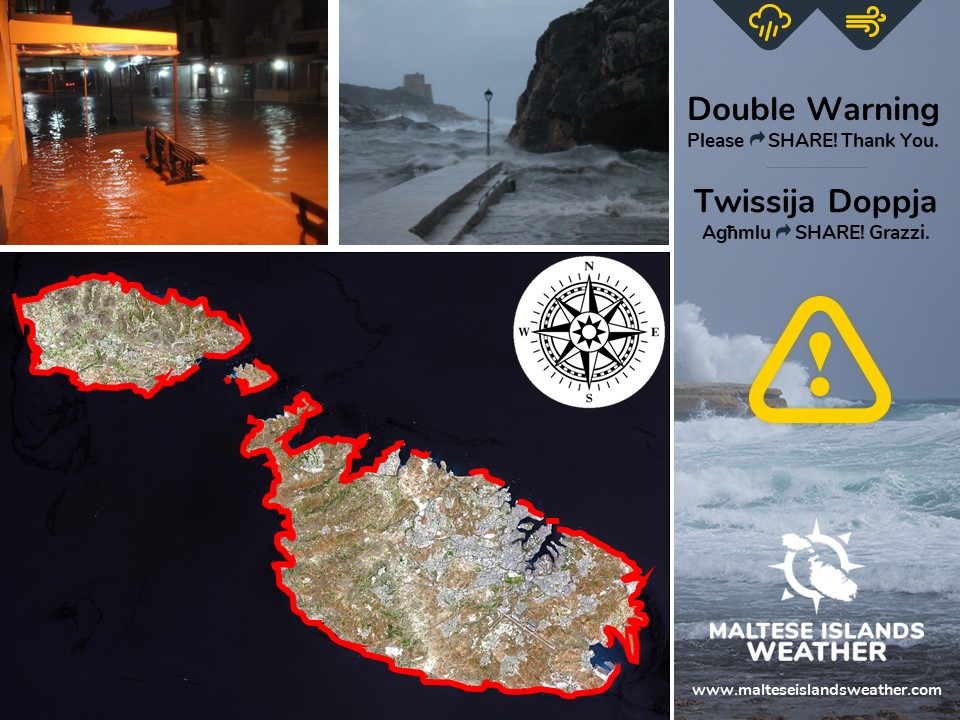
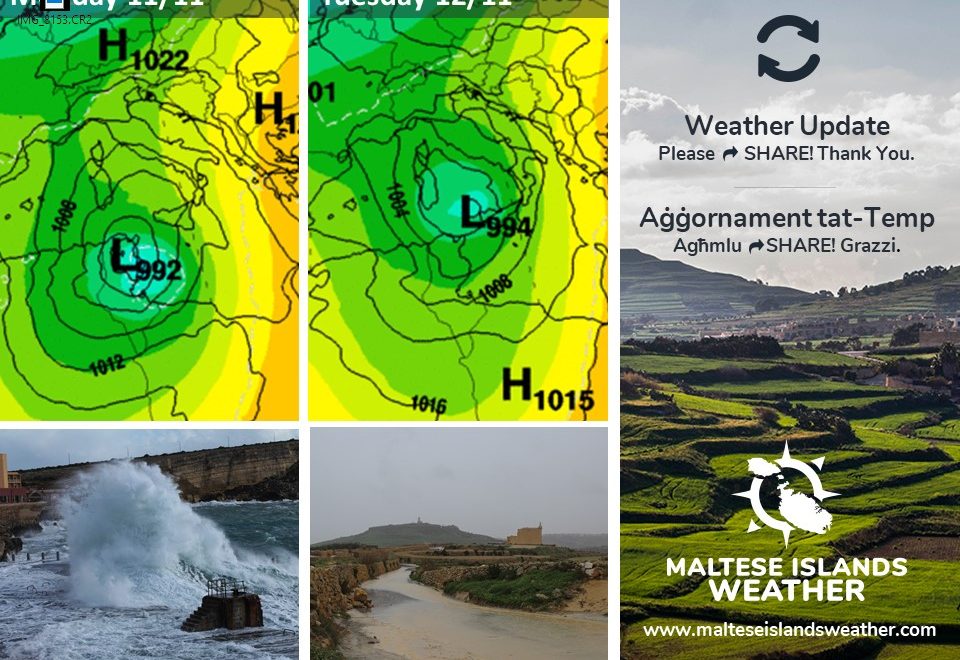
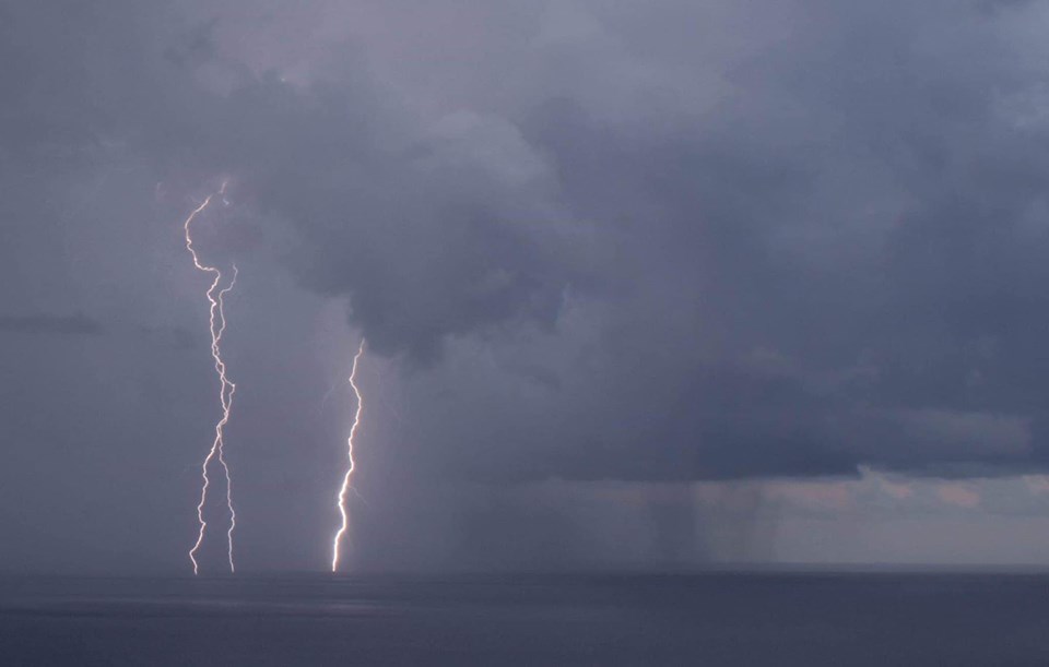
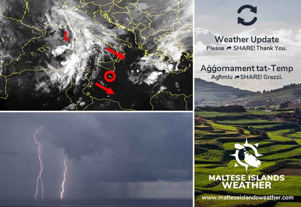
After the latest model updates, we have decided to issue two weather warnings. The main threats appear to be of heavy rainfall and gale force winds. An intense low pressure system over the western Mediterranean will move eastwards, deepening further as it does so. Some models suggest it may develop into a Mediterranean Tropical-Like Cyclone. At its closest, the system will be over Tunisia. The atmospheric pressure at its centre will be of 983hPa, a rare occurrence in the Mediterranean. Regardless of whether it transforms into a Mediterranean Tropical-Like Cyclone or not, it is almost certain that some very bad weather will be affecting the Maltese Islands.


HEAVY RAIN WARNING

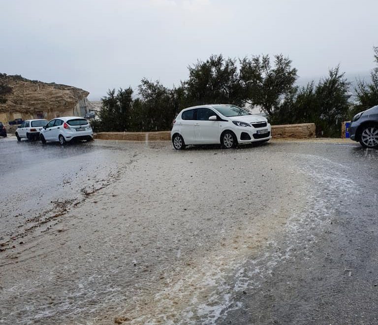
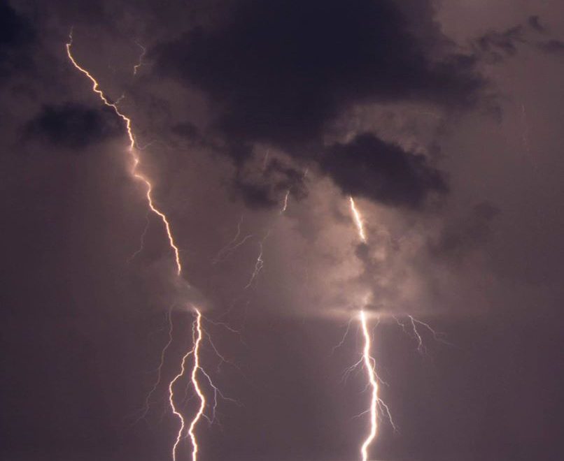
This warning is valid from noon on Monday 11/11 till 06:00 on Wednesday 12/11, although heavy rain showers will remain possible till later on Wednesday 13/11. As forecast since last week, the first half of this week will bring heavy to torrential rainfall to the Maltese Islands. A set of fronts associated with this vigorous low pressure system will move across the Maltese Islands on Monday 11/11 and Tuesday 12/11. A wide band of rain will be associated with these fronts. Some isolated thunderstorms should be embedded within. This band of rain should produce a lengthy period of steady rainfall, which will be heavy to torrential at times. This will affect us mainly in the afternoon and evening of Monday 11/11. The rainfall will be widespread, and therefore, all of the Maltese Islands should receive a significant amount of precipitation. Total rainfall amounts will range between 30 mm and 60 mm, with higher amounts possible across localised areas.


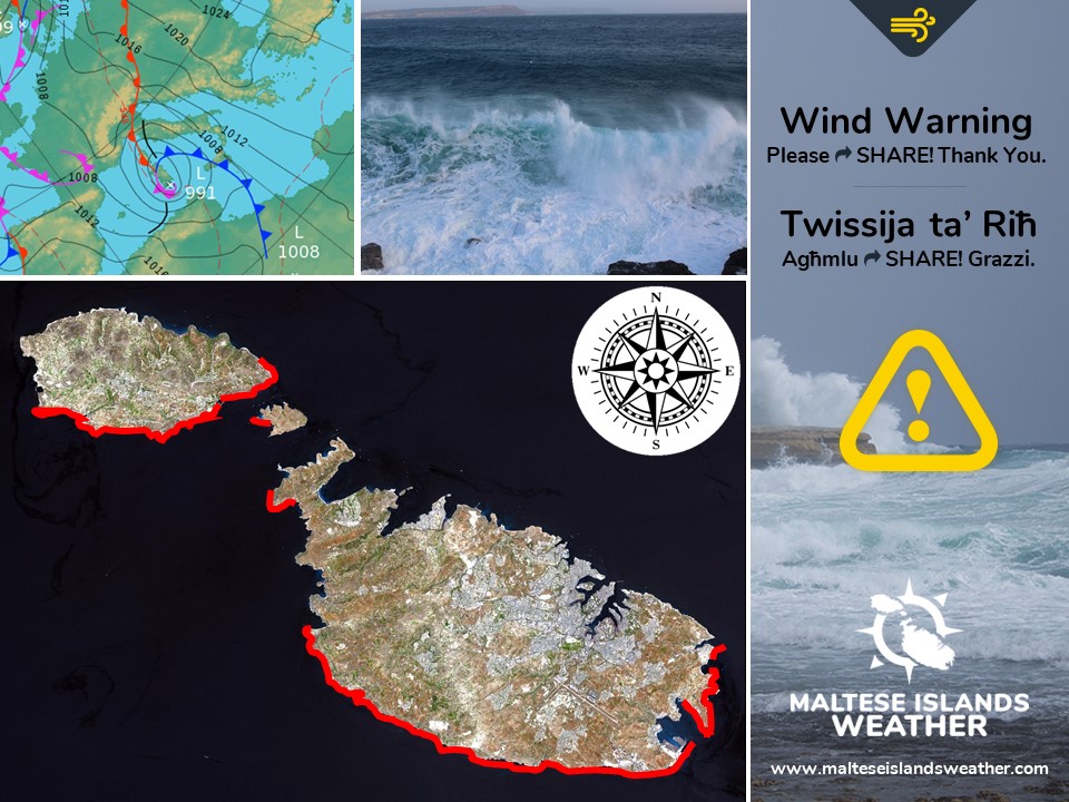
GALE-FORCE WIND WARNING

This warning is valid from 09:00 till 18:00 on Monday 11/11 and from 03:00 on Tuesday 12/11 till 09:00 on Wednesday 13/11. As forecast since last week, the first half of this week will also bring strong to very strong winds to the Maltese Islands. This wind will be the strongest since last February. The details below describe how the situation will develop over this time period.


Monday 11/11

09:00 to 12:00 – Southeast Force 5/6 to 6/7

12:00 to 15:00 – Southeast Force 6/7 to 7/8

15:00 to 18:00 – Southeast Force 7/8 to 5/6


Tuesday 12/11

03:00 to 06:00 – South Southwest Force 5/6 to 6/7

06:00 to 09:00 – South Southwest Force 6/7 to 7/8

09:00 to 12:00 – South Southwest Force 7/8 to 8/9

12:00 to 15:00 – South Southwest Force 8/9

15:00 to 18:00 – South Southwest Force 8/9

18:00 to 21:00 – South Southwest Force 8/9 to 7/8

21:00 to 00:00 – South Southwest to West Southwest Force 7/8


Wednesday 13/11

00:00 to 03:00 – West Southwest Force 7/8

03:00 to 06:00 – West Southwest to West Northwest Force 7/8 to 6/7

06:00 to 09:00 – West Northwest Force 6/7 to 5/6


The peak gusts will blow across the Maltese Islands in the late afternoon on Tuesday 12/11. They may reach Force 10 at times. The wind will remain at Force 5/6 or so for the rest of the week.

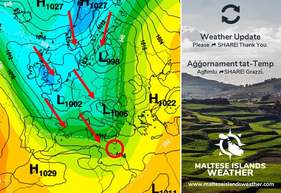
The sea will be very rough, with wave heights of up to 8.0 metres in peak gusts. The swell will be a low East. The map shows the length of coastline most exposed to this strong wind and very rough sea.


Wara l-aħħar aġġornament tal-mapep, iddeċidejna li noħorġu żewġ twissijiet. Il-periklu jidher li se jkun minn xita qawwija u riħ b’qawwa ta’ riefnu. Sistema ta’ pressjoni baxxa intensa fuq il-punent tal-Mediterran se tersaq lejn il-lvant, u se tissaħħaħ kif tagħmel dan. Xi mudelli qed jindikaw li din se tiżviluppa f’Medigan. Fl-eqreb punt tagħha lejn il-Gżejjer Maltin din se tkun fuq it-Tuneżija. Il-pressjoni atmosferika fiċ-ċentru tagħha se jkun ta’ 983hPa, ħaġa rari ferm ġewwa l-Mediterran. Irrispettivament jekk din issirx Medigan jew le, ninsabu kważi ċerti li se jkollna maltemp kbir ġewwa l-Gżejjer Maltin.


TWISSIJA TA’ XITA QAWWIJA

Din it-twissija se tkun fis-seħħ minn nofsinhar ta’ nhar it-Tnejn 11/11 sa nofsinhar ta’ nhar it-Tlieta 12/11, għalkemm ħalbiet tax-xita qawwija se jkunu possibli sa kmieni l-Erbgħa 13/11. Kif bassarna sa minn ġimgħa ilu, l-ewwel nofs ta’ din il-ġimgħa se jġib miegħu xita qawwija sa torrenzjali lejn il-Gżejjer Maltin. Sett ta’ fronti assoċjati ma’ din is-sistema ta’ pressjoni baxxa se jgħaddu minn fuq il-Gżejjer Maltin nhar it-Tnejn 11/11 u t-Tlieta 12/11. Firxa wiesgħa ta’ xita se tkun abbinata ma’ dawn. Xi maltempati bir-ragħad iżolati jistgħu jiżviluppaw ġewwa fiha. Din il-firxa wiesgħa ta’ xita se tipproduċi perjodi twil ta’ xita kontinwa, li se tkun qawwija għal torrenzjali kultant. Din se taffetwana l-aktar wara nofsinhar u filgħaxija ta’ nhar it-Tnejn 11/11. Ix-xita se tkun mifruxa, u għalhekk, il-Gżejjer Maltin kollha għandhom jaraw ammonti sostanzzjali ta’ xita. It-total ta’ xita se jvarja minn 30 mm sa 60 mm, b’ammonti ogħla possibbli lokalment.


TWISSIJA TA’ RIĦ B’QAWWA TA’ RIEFNU

Din it-twissija se tkun fis-seħħ minn 09:00 sa 18:00 ta’ nhar it-Tnejn 11/11 u minn 03:00 ta’ nhar it-Tlieta 12/11 sa 18:00 ta’ nhar il-Erbgħa 13/11. Kif bassarna sa minn ġimgħa ilu, l-ewwel nofs ta’ din il-ġimgħa se jġib miegħu wkoll riħ qawwi għal qawwi ħafna lejn il-Gżejjer Maltin. Dan ir-riħ se jkun l-aktar sa minn Frar li għadda. Id-dettalji ta’ hawn taħt juru kif se tiżviluppa s-sitwazzjoni matul il-ħin indikat.


It-Tnejn 11/11

09:00 sa 12:00 – Xlokk Forza 5/6 għal 6/7

12:00 sa 15:00 – Xlokk Forza 6/7 għal 7/8

15:00 sa 18:00 – Xlokk Forza 7/8 għal 5/6


It-Tlieta 12/11

03:00 sa 06:00 – Nofsinhar il-Lbiċ Forza 5/6 għal 6/7

06:00 sa 09:00 – Nofsinhar il-Lbiċ Forza 6/7 għal 7/8

09:00 sa 12:00 – Nofsinhar il-Lbiċ Forza 7/8 għal 8/9

12:00 sa 15:00 – Nofsinhar il-Lbiċ Forza 8/9

15:00 sa 18:00 – Nofsinhar il-Lbiċ Forza 8/9

18:00 sa 21:00 – Nofsinhar il-Lbiċ Forza 8/9 għal 7/8

21:00 sa 00:00 – Nofsinhar il-Lbiċ għal Punent Lbiċ Forza 7/8


L-Erbgħa 13/11

03:00 sa 06:00 – Punent Lbiċ għal Punent Majjistru Forza 7/8

06:00 sa 09:00 – Punent Majjistru Forza 7/8 għal 6/7

09:00 sa 12:00 – Punent Majjistru Forza 6/7

12:00 sa 15:00 – Punent Majjistru Forza 6/7

15:00 sa 18:00 – Punent Majjstru Forza 6/7 għal 5/6


Il-buffuri l-aktar qawwijin se jonfħu fuq il-Gżejjer Maltin tard wara nofsinhar ta’ nhar it-Tlieta 12/11. Dawn jistgħu jilħqu Forza 10 kultant. Ir-riħ se jonqos għal Forza 5/6 sa kmieni filgħaxija ta’ nhar il-Erbgħa 13/11, u jibqa hekk għal bqija ta’ din il-ġimgħa.

Il-baħar se jkun qawwi ħafna, b’mewġ għoli 8.0 metri fl-aktar buffuri qawwijin. L-imbatt se jkun baxx Lvant. Il-mappa turi l-kosta l-aktar esposta għal dan ir-riħ qawwi u l-baħar imqalleb ħafna.


Updates

Transit of Mercury / Transitu ta’ Merkurju

A transit of Mercury across the Sun occurs when the planet Mercury passes directly between the Sun and the Earth, becoming visible against (and hence obscuring a small portion of) the solar disk. During a transit, Mercury appears as a tiny black dot moving across the disk of the Sun. Transits of Mercury are much more frequent than transits of Venus, with about 13 or 14 per century, in part because Mercury is closer to the Sun and orbits it more rapidly. Transits of Mercury occur in May or November. The last four transits occurred on November 15, 1999; May 7, 2003; November 8, 2006; and May 9, 2016. The next will occur this Monday on November 11, 2019, and then on November 13, 2032. A typical transit lasts several hours. The final stages of the transit will not be observed from the Maltese Islands, as these will take place after sunset. The stages of the transit viewed from the Maltese Islands are seen below:

Partial Transit Begins: 13:35

Full Transit Begins: 13:37

Nearest Sun’s Centre: 16:19

Sunset: 16:56


The weather will, unfortunately, not be favourable to observe the transit. We expect cloudy skies with periods of heavy rain and strong to very strong winds.


Transitu ta’ Merkurju quddiem ix-xemx iseħħ meta l-pjaneta Merkurju tgħaddi direttament bejn ix-xemx u d-dinja. B’hekk, din tkun viżibbli bħala dell fuq wiċċ ix-xemx. Tul it-transitu, l-pjaneta Merkurju tkun viżibbli bħala tikka żgħira sewda għaddejja minn fuq ix-xemx. Transiti ta’ Merkurju huma ferm iżjed kommuni minn dawk ta’ Venere, bi 13 jew 14 minnhom f’kull 100 sena. Dan minħabba li Merkurju hija eqreb lejn ix-xemx u l-orbitu tagħha huwa ferm aktar mgħaġġel. Transiti ta’ Merkurju jseħħu f’Mejju jew Novembru libido-de.com/. L-aħħar erbgħa transiti seħħew nhar il-15 ta’ Novembru 1999, 7 ta’ Mejju 2003, 8 ta’ Novembru 2006 u 9 ta’ Mejju 2016. Li jmiss se jkun nhar it-Tnejn 11 ta’ Novembru 2019. Ta’ warajh iseħħ fit-13 ta’ Novembru 2032. Transitu tipikament idum xi ftit siegħat. L-aħħar stadji ta’ dan it-transitu mhux se jkunu jidhru mill-Gżejjer Maltin, minħabba li dawn se jseħħu wara nżul ix-xemx. L-istadji ta’ dan it-transitu se jseħħu kif indikat hawn:

Jibda t-Transitu Parzjali: 13:35

Jibda t-Transitu Sħiħ: 13:37

Merkurju l-Eqreb lejn iċ-Ċentru tax-Xemx: 16:19

Inżul ix-Xemx: 16:56


Sfortunatament, it-temp mhux se jippermetti li nosservaw dan l-avveniment ċelestjali bi sħiħ. Qed nistennew sema msaħħab b’perjodi ta’ xita qawwija u riħ qawwi għal qawwi ħafna.


Updates

Bad weather on its way / Ġej il-maltemp

Lots of rain is on the cards for the Maltese Islands during the first half of next week. An intense low pressure system (992hPa) will develop over the Gulf of Gabes. This may intensify into a Mediterranean Hurricane (or Medicane). It will move northeast over the course of next week. Its centre will pass to the northwest of the Maltese Islands as it does so. The Maltese Islands will be heavily impacted by this system. This system will affect us mainly from Monday 11/11 till Wednesday 13/11. There will be plenty of rainfall, some of which will be heavy at times. The heaviest rainfall will affect us from late on Monday 11/11 till early on Tuesday 12/11. The wind will be very strong at times, particularly from late in the morning on Tuesday 12/11 till early in the afternoon on Wednesday 13/11. The Southwest to West wind may reach Force 8/9 at times then. Temperatures will also be colder than average for these three days, mostly on Tuesday 12/11. Highs will struggle to reach 15 C on that day. Lows may dip to below 10 C at night.

Ħafna xita hija mistennija lokalment fl-ewwel ġimgħa tal ġimgħa li ġejja. Sistema intensa ta’ pressjoni baxxa (992hPa) se tiżviluppa fuq il-Golf ta’ Gabes. Din taf tintensifika u ssir urugan tal-Mediterran (Medicane). Din is-sistema se timxi lejn il-Grigal tul il-ġimgħa li ġejja. Iċ-ċentru tagħha se jgħaddi lejn il-Majjistral tal-Gżejjer Maltin. Il-Gżejjer Maltin jafu jkunu affetwati sew minn din is-sistema’. Din il-pressjoni baxxa se tmissna l-aktar mit-Tnejn 11/11 sa l-Erbgħa 13/11. Se jkollna ħafna xita, li se tkun qawwija kultant. L-aktar xita qawwija mistennija bejn it-Tnejn 11/11 u t-Tlieta 12/11. Ir-riħ se jkun qawwi kultant ukoll, speċjalment minn tard it-Tlieta 12/11 sa kmieni wara nofsinhar l-Erbgħa 13/11. Ir-riħ se jkun mill-Lbiċ għal Punent u se jilħaq Forza 8/9 kultant. It-temperaturi se tkunu anqas mill-medja wkoll f’dawn it-tlett ijiem, speċjalment it-Tlieta 12/11. L-ogħla se tbati biex titla 15 C dakinhar. L-anqas taf tinzel taħt 10 C billejl.

Updates

A little rain overnight / Xi ftit xita billejl

A cold front associated with a low pressure system traversing the central Mediterranean will bring some showers to the Maltese Islands at night. These showers will last only briefly, as the strong wind from the Northwest is to push them past quickly. Any showers may be briefly heavy and thundery. The chance of rain will be highest from midnight till 06:00 on Thursday 07/11. Total rainfall should not exceed 10 mm. The sky will clear up by early afternoon. The Northwest wind will continue reaching Force 5/6 ahead of the cold front, before decreasing slightly by the morning. Temperatures will also be considerably cooler.

Front kiesaħ abbinat ma’ pressjoni baxxa li tinsab għaddejjha minn fuq iċ-ċentru tal-Mediterran se ġġib magħha xi ħalbiet tax-xita lejn il-Gżejjer Maltin billejl. Ix-xita se ddum biss għal ftit ħin, peress li r-riħ qawwi mill-Majjistral se jimbotta l-maltemp lejn il-lvant b’mod mgħaġġel. Ix-xita taf tkun qawwija u bir-ragħad għal ftit ħin kultant. Iċ-ċans ta’ xita se jkun l-ogħla minn nofsillejl sa 06:00 tal-Ħamis 07/11. It-total ta’ xita ma għandux jaqbez 10 mm. Is-sema se jiċċara sa kmieni wara nofsinhar. Ir-riħ mill-Majjistral se jibqa jilħaq Forza 5/6 sa ma jgħaddi l-front. Wara, dan se jonqos daqsxejn sa filgħodu. It-temperaturi se jonqsu b’mod sinifikanti.

Updates

First cold spell of the season / L-ewwel mewġa ta’ kesħa ta’ l-istaġun

A blast of cold air from the north will bring average or colder than average temperatures to much of Europe and the Mediterranean. This includes the Maltese Islands. Starting tomorrow, maximum temperatures will no longer rise to above 21 C. Nighttime lows will be at or below the 15 C mark. The coldest weather is expected on Monday 11/11 and Tuesday 12/11. On both days, highs will struggle to reach 15 C. Lows may go down to 10 C or colder for the first time since February. The colder temperatures will be accompanied by a strong to very strong wind from the Southwest to Northwest. There will also be plenty of rain, especially from Monday 11/11 till Saturday 16/11. More details about the strong to very strong wind and rain will be given in separate updates at a later date.

Massa ta’ arja kiesħa mit-tramuntana se ġġib magħha temperaturi daqs jew anqas mill-medja għal biċċa l-kbira ta’ l-Ewropa u l-Mediterran. Dan jinkludi l-Gżejjer Maltin. Minn għada, it-temperaturi massimi mhux se jibqgħu jaqbżu l-21 C. L-anqas billejl se jibdew ikunu ta’ 15 C jew anqas. It-temp mistenni jkun l-aktar kiesaħ nhar it-Tnejn 11/11 u t-Tlieta 12/11. F’dawn il-jumejn, l-ogħla se tbati biex tilħaq 15 C. L-anqas tista tinżel sa 10 C jew aktar kiesħa. Din tkun l-ewwel darba li t-temperatura se tinżel taħt 10 C minn Frar. It-temperaturi kesħin se jkunu akkumpanjati minn riħ qawwi għal qawwi ħafna mill-Lbiċ għal-Majjistral. Se jkun hemm ukoll ammont ta’ xita sinifikanti, speċjalment minn nhar it-Tnejn 11/11 sas-Sibt 16/11. Aktar dettal dwar ir-riħ qawwi għal qawwi ħafna u x-xita jinħarġu aktar ‘il quddiem f’aġġornamenti separati.

Updates

Light thunderstorm at night? / Maltempata ħafifa billejl?

The edge of a cold front associated with an intense low pressure system over the Gulf of Genoa will brush past the central Mediterranean in the early hours of Monday 04/10. This will bring showers and thunderstorms to Sicily. A few of these could extend south enough to also affect the Maltese Islands. Of particular interest to us is a potential isolated thunderstorm. The chance of rain will be highest from midnight till 09:00 on Monday 04/11. Total rainfall should not exceed 10 mm. The sky will clear up by late morning. The Southwest wind will continue reaching Force 5/6 ahead of the cold front, before backing West Northwest and decreasing gradually over the course of the day on Monday 04/11.

It-tarf ta’ front ta’ arja kiesħa abbinat ma’ sistema ta’ pressjoni baxxa intensa fuq il-Golf ta’ Genoa mistenni jgħaddi bi żbrixx minn fuq iċ-ċentru tal-Mediterran fis-siegħat bikrijin tat-Tnejn 04/11. Sqallija se tkun milquta minn xita u maltempati. Xi ftit minn dawn jistgħu jersqu lejna wkoll. Ta’ interess għalina hija l-possibilita’ ta’ maltempata ħafifa u iżolata. Iċ-ċans ta’ xita se jkun l-ogħla minn nofsillejl sa 09:00 tat-Tnejn 04/11. It-total ta’ xita ma għandux jaqbeż l-10 mm. Is-sema se jiċċara sa tard filgħodu. Ir-riħ mill-Lbiċ se jkompli jilħaq Forza 5/6 sa ma jgħaddi l-front kiesaħ, qabel ma jaqleb Punent Majjistru u jonqos gradwalment matul il-jum tat-Tnejn 04/11.

Updates

Rainy start to November 2019 / Novembru 2019 jibda bix-xita

Two successive troughs of low pressure over the western Mediterranean will progress to the southeast, reaching the central Mediterranean. They are expected to reach our region during the night or in the morning of Friday 01/11. Associated with these are a mass of showers and isolated thunderstorms. This will pass over the Maltese Islands at night or in the morning of Friday 01/11. Expect showers that will be heavy and thundery at times. Residual showers will linger on till late on Friday 01/11, possibly even the morning of Saturday 02/11. Total rainfall may reach 15 mm in places.

Żewġ fronti ta’ pressjoni baxxa fuq il-punent tal-Mediterran se jersqu lejn ix-xlokk, biex b’hekk jilħqu ċ-ċentru tal-Mediterran. Dawn mistennija li jilħquna matul il-lejl li jew kmieni l-Ġimgħa 01/11. Assoċjati ma’ dawn il-fronti hemm massa ta’ ħalbiet tax-xita u maltempati bir-ragħad iżolati. Dawn se jgħaddu minn fuq il-Gżejjer Maltin billejl jew filgħodu tal-Ġimgħa 01/11. Jekk imissuna, stennew ħalbiet tax-xita li se jkunu qawwijin jew bir-ragħad kultant. Ħalbiet tax-xita residwi jistgħu jibqgħu sejrin sa tard il-Ġimgħa 01/11 jew anke kmieni s-Sibt 02/11. It-total ta’ xita jaf jilħaq 15 mm f’xi nħawi.